Gods and government, proud warriors and foreign invaders: discovering the landscapes and history of Atiu… South Pacific Adventure, part 8.

(For new readers – if you’re just discovering this blog and you would like to read about my 2015 South Pacific travels from their beginning, you can click on this link to go to the first chapter:  Travels in the Cook Islands.)

Forest road on Atiu, the Cook Islands.

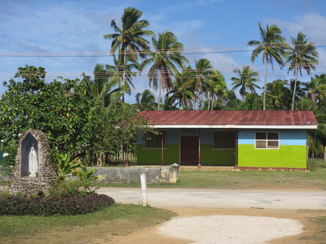
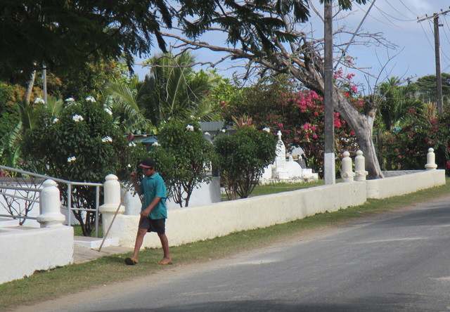
My second day on Atiu began with a gargantuan breakfast, fuel for the day’s explorations. Donna, Mark and I then jumped into Marshall’s truck and we picked up the three other tourists currently staying on the island, before heading out on a tour. First stop was the nearby village of Teenui, the closest thing that Atiu has to a busy metropolis.

Downtown Teenui village, Atiu (the Cook Islands).

On an island with a population of around 500 people, you’re unlikely to see much other traffic (apart from chickens). Marshall gave us a tour of Teenui’s sights, starting with the recently-created sports field, which had to be redone after the island was hit by five cyclones in a single season. Climate change is likely to lead to intensified cyclone activity in the South Pacific, so this doesn’t bode well for the people who live on islands such as Atiu.

Teenui sports field on Atiu, the Cook Islands.

We drove past the village store, which was originally the first school on the island (built by the London Mission Society). As elsewhere in the Cook Islands, imported (mostly Christian) religions have had a big impact on local society and culture. There are six churches on Atiu, including CICC (Cook Islands Christian Church), Catholic, Seventh Day Adventists and Jehovah’s Witnesses. Atiu people can and do marry folks from different churches, although this depends on each church’s policy: not every faith allows it.

Church in Teenui, Atiu (the Cook Islands).

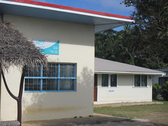
Our next stop was the island police station (which also serves as Teenui’s bank and post office). Marshall explained that there are two police officers on Atiu, and the consensus is that no crime occurs after 3pm because that’s when they go off-duty… Or on Friday afternoons, because that’s the time for fishing. I quite liked the idea of limited hours for law-breaking. Presumably having the bank attached to the police station also discourages would-be bank robbers (unless of course they decide to carry out a bank raid after 3pm).

Police station, bank and post office in Teenui, Atiu (the Cook Islands).

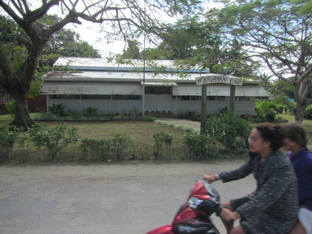
The legacy of colonial occupation can be seen in government buildings, as well as in the ubiquitous churches. Atiu’s council chamber and tax filing office (Kavamani Enua, or Island Government) are based in what used to be the old British Foreign Office building, when B.F.O. staff were posted on the island. British colonial rule from the 1880s became New Zealand colonial rule in 1901: full independence and self-governance in the Cook Islands not being achieved until 1965.

Island government building in Teenui, Atiu (the Cook Islands).

Other important buildings we saw included the CICC hall, used for singing and dancing events; and the CICC church building itself, the largest church on the island. As on Aitutaki, there were very few graves beside the church, with local people choosing to bury their deceased family at home: only incomers or strangers usually find their resting place in the church cemetery.

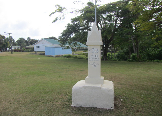
Next to the church a limestone obelisk called te pito, ‘the navel’, marks what is said to be the exact centre point of the island. It carries the name of Paulo Ngamaru Ariki, the Atiuan chief who helped restore the CICC church in the 1950s; and Tamaivi Ngamaru Ariki, the chief who planned and built the original church in the 1860s. There are three ariki (chiefs) on Atiu: at the time of my visit only two lived on the island, while the third resided in New Zealand. Ariki descends in family lines, but not automatically to the eldest son of the family: local worthies meet to decide who will make the best successor, when the current ariki dies.

Monument to Atiuan chiefs Paulo Ngamaru Ariki and Tamaivi Ngamaru Ariki, at the centre of Atiu in the Cook islands.

As we travelled around Teenui it was quiet: we saw the occasional local driving a pick-up or moped; children strolling or playing; and of course chickens and dogs patrolling the mostly empty roads. With the population size having reduced by two-thirds in the late twentieth century (mostly due to the decline of exports of produce such as citrus fruits, coffee and copra), community life here is small-scale but still vibrant, with regular community meetings in each of the five villages.

Atiuan boy raking up leaves in Teenui, Atiu (the Cook Islands).

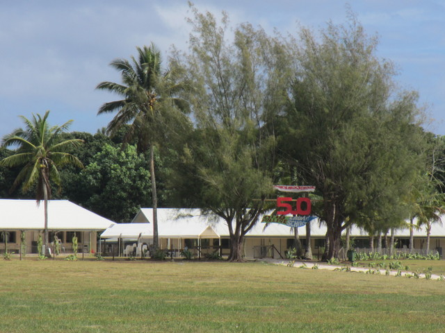
Heading out of Teenui our next stop was the island’s Enuamanu School, which bore a banner celebrating 50 years since the school – and Cook Islands self government – was established in 1965. All stages of education – infants, primary, secondary and college – are contained on the same site. Marshall told us that Cook Islands Maori is the first language taught in Enuamanu School and English second (unlike on Rarotonga). This prioritising of Cook Islands language seems positive, though unfortunately Atiu pupils are disadvantaged when they sit exams under the New Zealand exam system, as exams are set in English. Marshall said that for this reason he and Jéanne home-educated their children, to try to overcome this problem.

Enuamanu School, Atiu (in the Cook Islands).

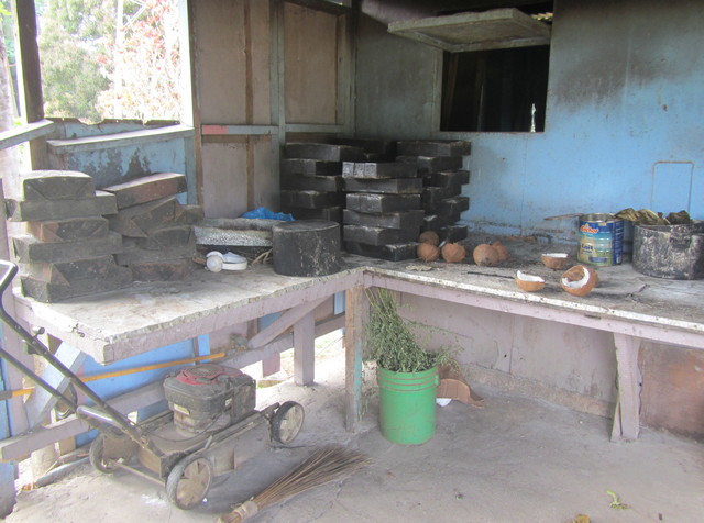
After the school our next landmark was the village bakery, complete with cement bread oven! It reminded me of the cob oven (earth oven) at Wildwood Escot where I teach in Devon: basically a simple interior oven space enclosed in thick cement walls, heated by burning firewood inside. Should any cracks form in the oven’s walls (revealed by leaking smoke), this is mended by the simple expedient of plastering more cement on the outside… Hence the resulting huge oven structure, sheltering under its corrugated iron roof.

Bread oven in Atiu's bakery, the Cook Islands.

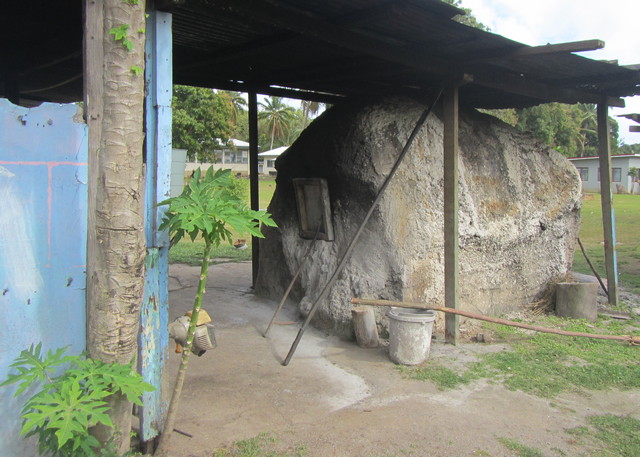
Once the wood has burned and the oven is heated, the ashes are swept out and the tins of bread dough popped inside to bake. The whole set-up is basic but practical, with the only machinery used a giant dough mixer that looked more like a cement mixer than anything else! I quite liked the minimalist kitchen (although I’m not sure what having a lawnmower stored in there added to the mix).

Bread tins in Atiu's bakery (the Cook Islands).

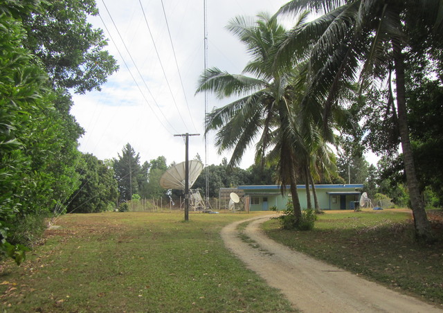
A little further down the road lay Atiu’s telecom mast, phone satellite and TV station. Microwave antennae capture signals transmitted from Mangaia and Mitiaro and boost them onwards. Atiu’s TV channel can receive several signals, but can only transmit one signal at a time to island residents – so locals have to be patient and cooperate with each other, taking turns to watch their favourite TV programmes. At least that avoids TV ratings competition…

Phone satellite, telecom mast and TV station on Atiu, the Cook Islands.

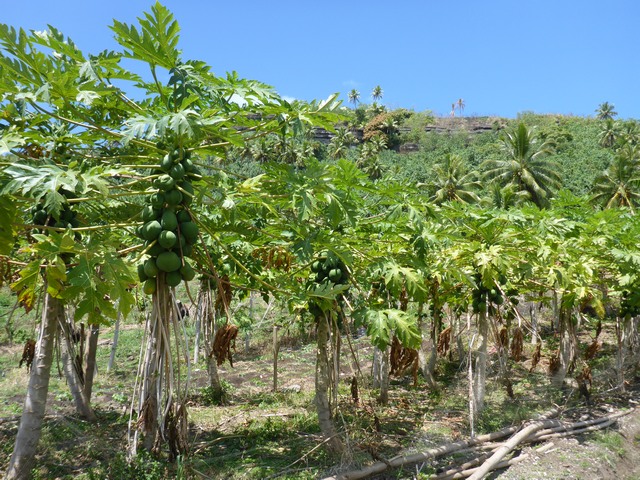
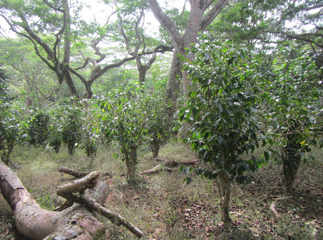
Our next stop was at a coffee plantation, formerly owned and run by German growers Juergen Manske-Eimke and his wife Andrea. Their business ended when Juergen sadly died in mid-2015, but the coffee bushes were continuing to grow well. Missionaries first brought coffee to the island, and it became a cash crop in the 1950s. The island’s calcium-rich soils lend Atiu coffee a unique flavour, and despite fluctauations in the coffee trade it continues to be grown and sold. The production of Atiu Island Coffee is now headed up by local woman Mata Arai, using hand picking and roasting with coconut cream, giving this coffee a very special taste.

Coffee plantation on Atiu, the Cook Islands.

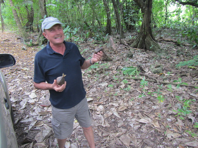
Coming through the forest we emerged near the island’s airport. While we watched a Pacific golden plover or toretoreā (Pluvialis fulva) pottering about on the runway, Marshall related how an Air Raro plane had a tyre blowout while taxiing on the crushed coral runway a year or so previously. It must be interesting being an Air Raro pilot! A request had gone in for a new tarmac runway to replace the crushed coral surface. Locals had already begun clearing the site and bringing in machinery, only waiting for funding to be found so that they can begin work. Marshall also showed us two massive blocks of coral (each half as big as the pick-up we were riding in) that had been thrown up onto the runway by the sea during a cyclone in 2005.

Makatea cliffs on the northeast coast of Atiu, the Cook Islands.

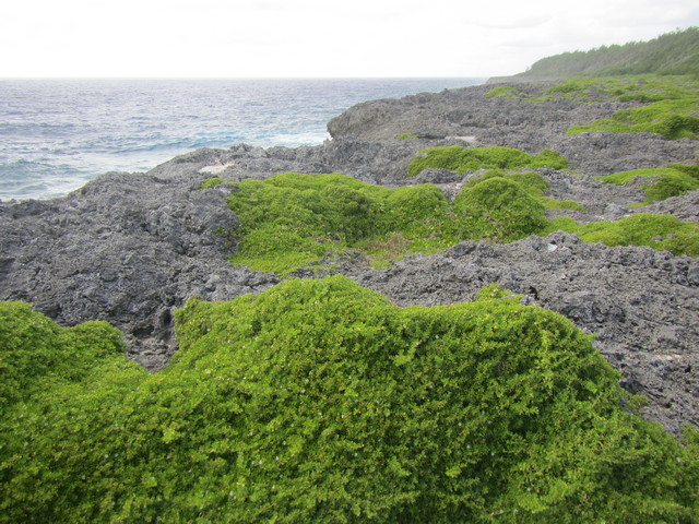
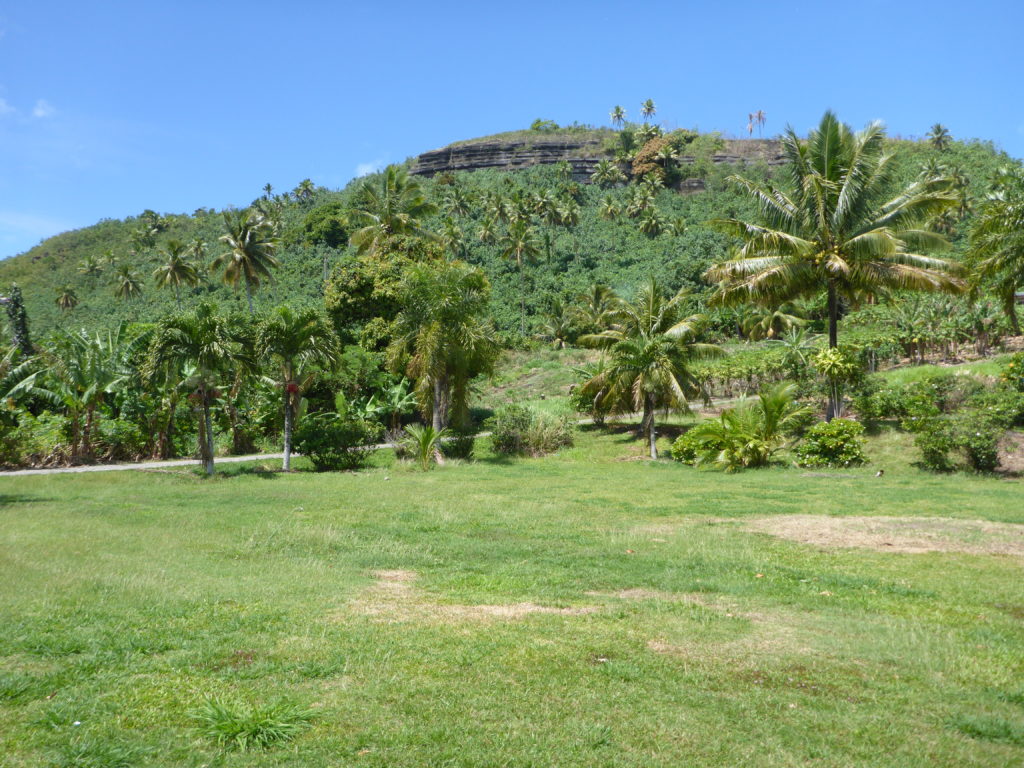
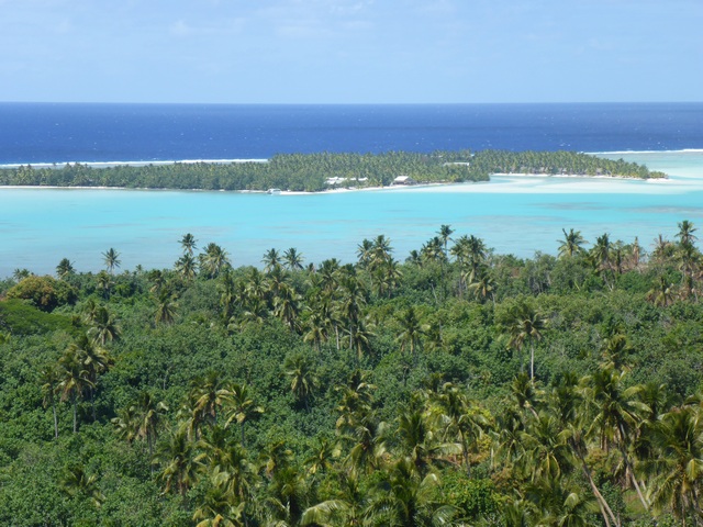
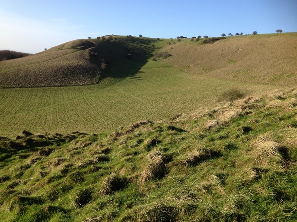
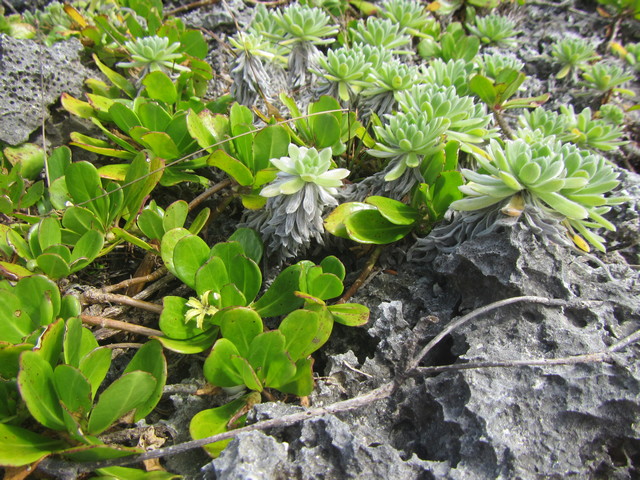
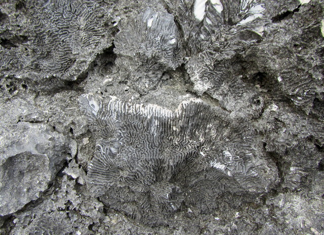
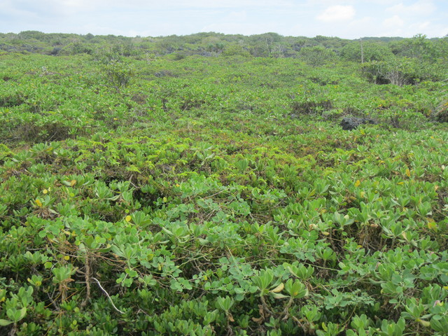
Southeast of the airstrip we hopped out of Marshall’s pick up to walk over the makatea to the cliff tops on Atiu’s northeastern edge. Just as we’d found the day before when trekking to Anatakitaki, walking on makatea requires concentration. We were stepping over a fossilised coral reef, its rugged and undulating topography mirroring the choppy Pacific swell surging below us. Hardy plants such as ngau (Creeping half-flower, Scaevola paulayi) wedged their roots into the crevices, growing in wind-resistant mats and weathering the salt spray.

Plants growing on makatea (fossilised coral) on Atiu, the Cook Islands.

It wasn’t easy to picture the sharp crags of limestone that we were walking on as an undersea coral reef, millenia ago… Until I crouched down and looked closer, when an ancient tropical ocean landscape became revealed. I saw intricate patterns of many different coral species: hieroglyphics written in the skeletons of billions of long-dead coral polyps. There is always something mesmerising to me about being confronted with the geological evidence of deep time. Humanity takes itself and its everyday concerns so seriously… But really we’re just a recent blip on the evolutionary timeline. For some reason I find this weirdly comforting.

Fossilised corals in makatea limestone, Atiu (the Cook Islands).

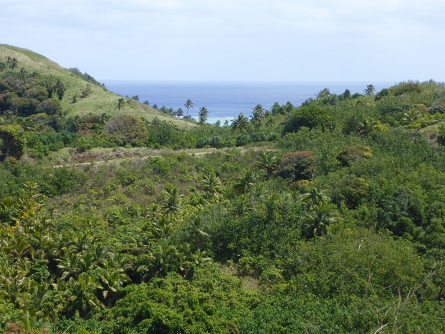
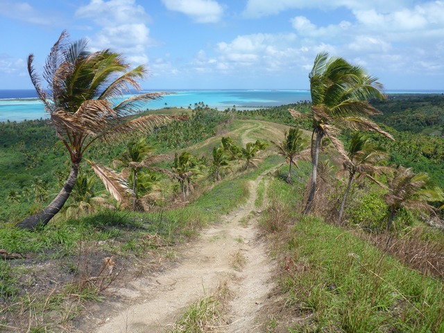
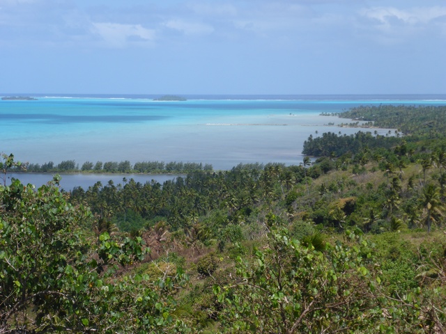
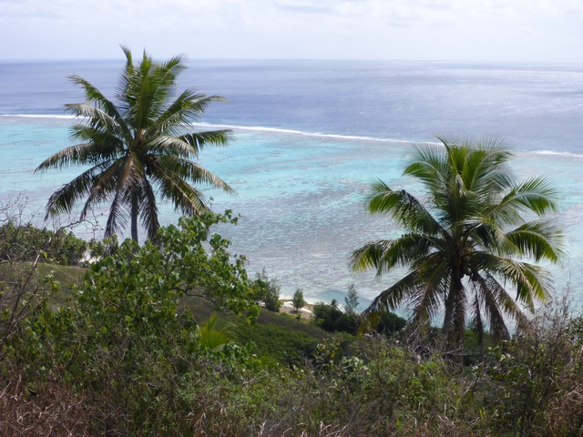
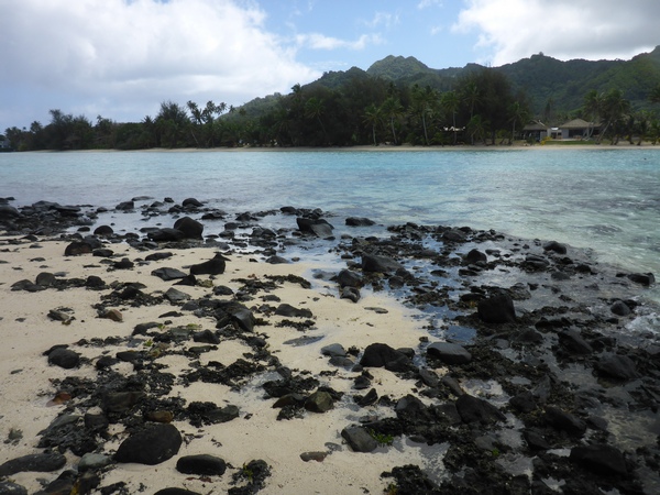
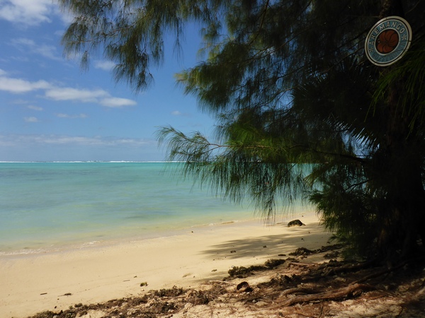
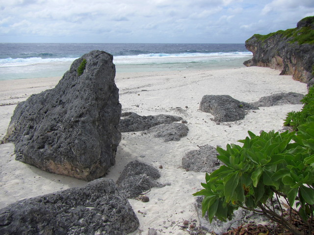
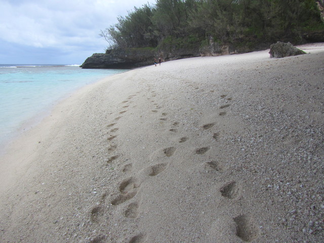
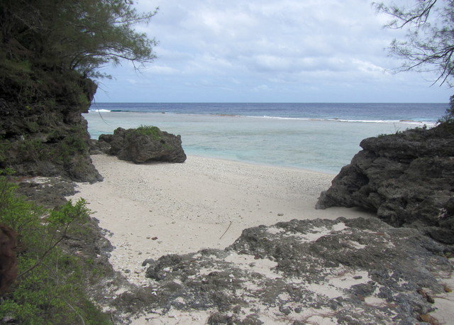
Driving soutthest took us along the coast road that runs all the way around Atiu, with its handy signs at intervals indicating the distance to landmarks in either direction. Our next stop was at Oneroa Beach, a beautiful little cove with pinkish coral sand used by Marshall and Jéanne’s family. The edge of the reef is very close here, the wild Pacific surf rolling just a few metres out.

Oneroa Beach on Atiu, the Cook Islands.

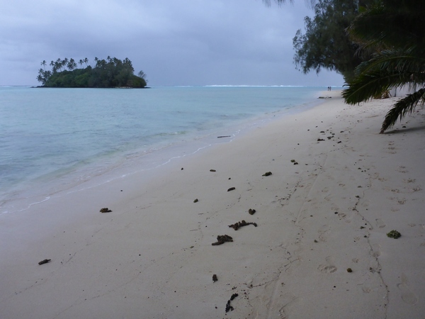
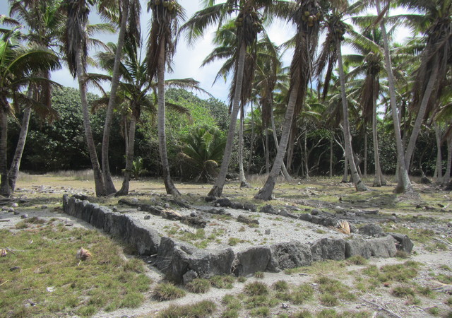
After a brief but lovely wander along Oneroa Beach, we returned to the truck and drove on along the coast road to Takauroa Landing on the island’s southern edge. This was the scene of an epic battle between Atiu warriors and invaders from Tahiti. History tells of how a Tahitian traveller shipwrecked on Atiu was cared for and nursed back to health by Atiu folk, but then travelled back to Tahiti… Only to return to Atiu with two vaka (war canoes) loaded with two hundred Tahitian warriors! Fortunately for the locals they were able to ambush the Tahitian invaders as they tried to access the island’s interior through a narrow passage in the makatea: after a pitched battle the Atiuans won. The ungrateful Tahitian who’d led his fellows back to Atiu was reputedly hunted down, fought with by the ariki, and killed. (And allegedly eaten, which seems fair enough.) Two marae at Takaroa Landing mark the burial sites of all those warriors who fell in battle defending their island.

Marae at Takauroa Landing on Atiu, the Cook Islands.

Here in the southern part of the island, the makatea is pretty impenetrable, with its combination of thick tangled undergrowth and forest on top of sharp craggy fossilised limestone. Marshall related how a local lawbreaker evaded arrest by local police for some time by hiding out in the makatea. After a few weeks however the wrongdoer turned himself in, finding living in the challenging landscape of the makatea too difficult!

Makatea scrub on Atiu, the Cook Islands.

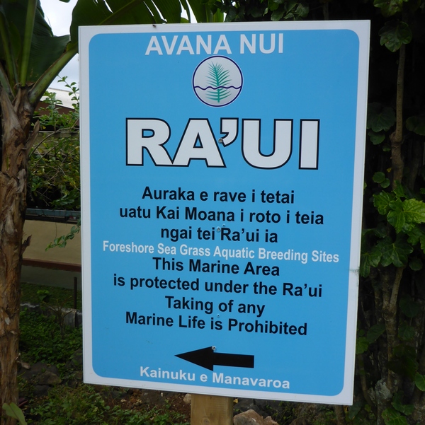
A little further on into the coastal forest Marshall stopped the truck to show us a fruits from a boxfruit tree (Barringtonia asiatica or ‘utu). The seed from the centre of ‘utu fruits can be ground up or chopped to release a poison, which paralyses fish if the ground seeds are scattered into the sea. Formerly used for fishing in the coral lagoon, this is now illegal: a local man was recently caught using ‘utu poison in this way and fined $500 (after having been warned several times not to do this).

Marshall Humphreys displays Baringtonia or 'utu fruits, once used to poison fish but now illegal (Atiu, the Cook Islands).

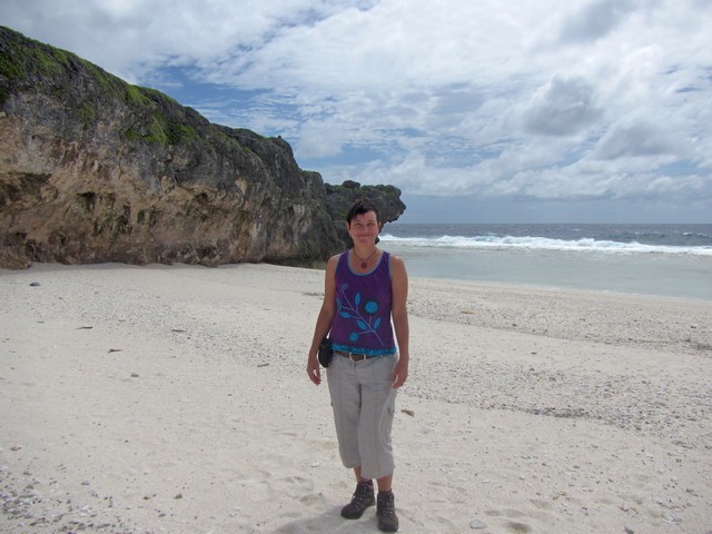
Heading now up the western side of the island we stopped at Taungaroro Beach, which like Oneroa was beautiful and deserted. Walking through the sand and looking out to the Pacific waves splashing against the coral reef, I felt a little like Robinson Crusoe (although hopefully without the white imperialist overtones).

Taungaroro Beach on Atiu (the Cook Islands).

It’s not just coral which makes up the pinkish sands fringeing these islands: billions of fragments of seashells too are rendered down by the action of waves and wind to create the lovely beaches that are such an iconic element of Pacific islands. I spent a happy half hour wandering and gathering seashells, including many cowries or pōre‘o. In many places in the world cowries have traditionally been used as currency: in the Cook Islands they were favoured more for jewellery, especially to convey status to the wearer.

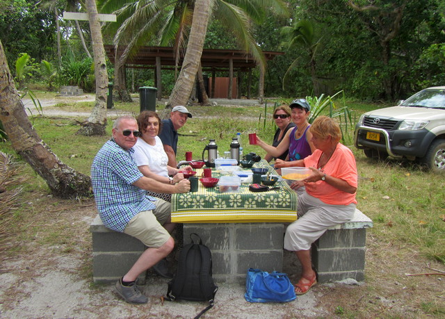
Taungaroro was also the spot where we had a picnic lunch, to fortify us after our morning’s exploring. Banana muffins, fresh fruit salad with papaya and guava and pawpaw sprinkled with grated coconut, and a nice cup of tea to wash it all down: perfect.

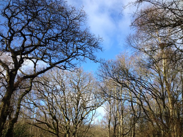
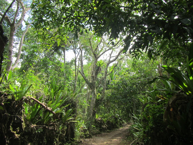
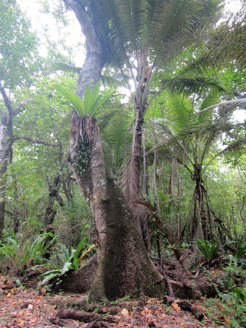
After lunch I went wandering a little way into the coastal forest, to admire the tropical trees with their buttressed roots and epiphytic ferns growing in nooks amongst the branches. Atiu was a delight to a plant nerd like me: while my tropical botany knowledge wasn’t good enough for me to identify many species, I still felt happily at home in this green growing ecosystem, relatively unimpacted by tourism.

Tree growing in coastal forest, Atiu (the Cook Islands).

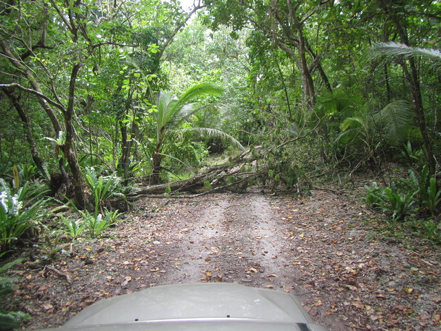
The plan was for us to continue on up the coastal road northwards to Oravaru landing – but our plans were temporarily foiled by a roadblock in the form of a fallen tree. We detoured via Ngatiarua village and back out to the coast by another route, finally reaching Oravaru on the west coast.

Fallen tree blocking coastal road, Atiu (the Cook Islands).

If you search on the internet for information about the Cook Islands’ colonial history, it describes how Spanish explorers sighted Pukapuka and Rakahanga (in the northern islands group) in 1595 and 1606; then Captain James Cook sighted other islands in the 1770s; followed by Captain William Bligh in 1789 (whose tyrannical captainship led to the mutiny on his ship the Bounty). The name ‘the Cook Islands’ was conferred by Russian navigator Adam Johann von Krusenstern in his 1823 Atlas de l’Ocean Pacifique, in honour of the surveying and mapping done by Captain James Cook: previously they were named the Hervey Islands after a British Lord of the Admiralty.

Ironically Cook himself never landed on Atiu during his voyage on the ship Resolution: instead one of his officers, Lieutenant John Gore went ashore in 1777, accompanied by the ship’s doctor, botanist and three boatloads of crew. They were met by some two thousand Atiuan warriors and people lining the clifftops, with full body tattoos and carrying spears – no doubt an intimidating sight. Bear in mind that on one of Cook’s previous expeditions to Tahiti, John Gore was the first person ever recorded to shoot and kill an indigenous Pacific Maori person, after an altercation over a piece of cloth. These were not casual explorers but the vanguard of a powerful military empire, intent on mapping and colonising what they regarded as ‘uncivilised’ territories, largely ignoring the rights of the indigenous people already living there.

Oravaru Landing, where Captain James Cook's crew first landed on Atiu in 1777 (the Cook Islands).

Gore’s party were taken inland by the Atiuans to the Orongo marae and cave of the warriors, which would have been an impressive and unsettling sight. It’s said that the landing party’s Polynesian interpreter saw a prepared umu pit (earth oven) but no animal carcasses, and assumed that this meant that they were on the menu! This proved not to be the case however: after being ceremonially introduced to the ariki and being the subject of several hours of close curiosity from the Atiuans, the landing party was allowed to return to their ship.

Marshall told us of an ancient local tradition, that when a new baby boy was born the child was taken to the tribal priest at the Orongo marae, who would wrap the baby up in leaves and leave him on the marae altar overnight. In the morning if the baby had managed to break free of his leaf swaddling he would be raised as a warrior at the Orongo marae and taught how to fight. If the baby was still wrapped in the leaves, the child would be returned to his parents and grow up to be a fisherman or planter.

Orongo marae was also the final resting place of the skulls of the island’s ariki, as well as those of great and heroic warriors. It was and still is a sacred place. In the 1960s two Mormon missionaries visiting the island were disrespectful and foolish enough to remove a skull from the Orongo cave, intending to take it with them to Rarotonga… But the woman missionary died before they got there. The skull was swiftly returned and replaced at Orongo.

The archaeology and history of pre-colonial times in the Cook Islands was seemingly only just beginning to be shown the interest and respect it deserves, at the time of my visit in 2015. I was reminded of Ngaa’s determined labours on Aitutaki to preserve and pass on the culture and history of his people. Compare this with the wealth of research and fieldwork that has been done on ancient cultures such as Egypt, Greece and South America. I suspect that partly this is due to the legacy of colonialism, and the fact that we white Europeans are still reluctant to engage with the reality of our colonial history: a history that contains a great deal of brutality and exploitation, and which persists to this day in some people’s colonial or white supremacist mindset. Too often I’ve heard white people try to diminish the impact of colonialism by saying “Explorers then didn’t know any better”, or “Every European nation was doing the same thing”, or even “These cultures had plenty of their own problems before we came along – what about their inter-island wars and cannibalism?” These defensive responses are missing the point: white colonial powers invaded lands, imposed Christian religion (with all its guilt-ridden and problematic dogma), took whatever resources they fancied, and ruthlessly eradicated many indigenous people through military force and disease. If someone did that to Britain we’d call it an act of war.

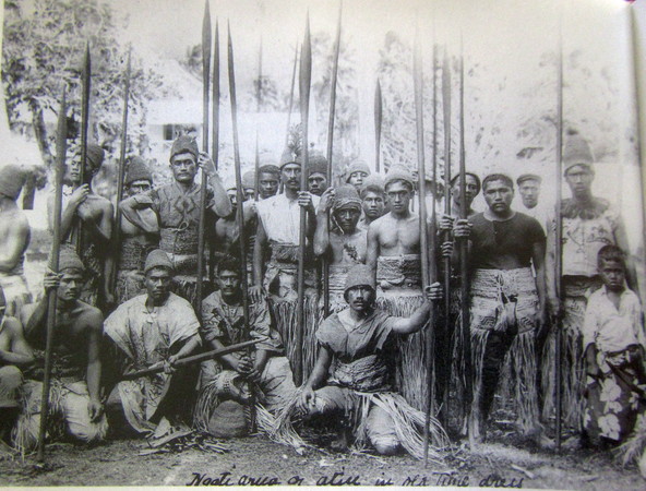
When we returned to Marshall and Jéanne’s home, I found a wonderful book on their shelves: Akono’ango Maori: Cook Islands Culture, by Ron Crocombe. Browsing through it I came upon a remarkable photograph taken circa 1904, titled ‘Ngatiarua on Atiu in old time dress‘. The dignity and pride of these muscled men standing with their heavy spears, gazing directly into the camera lens, shone out of the page.

Ngatiarua men on Atiu, the Cook Islands: photo taken circa 1904.

As a privileged white tourist in the South Pacific, I felt enormously grateful to have the opportunity to travel in these beautiful islands, and to meet the friendly and generous people who lived there. This friendliness and generosity is even more remarkable, given the explotiation of their lands and people ever since white colonisers first began occupying their territories. Writing this blog is my effort to show my gratitude to all the Cook Islands and South Pacific Maori and Polynesian people who welcomed me into their homes; and to raise awareness as far as I can of the destructive impact of European colonialism, and the importance of honouring South Pacific culture. It’s vital too that we take rapid steps to limit climate change caused by our industrialised nations, the latest colonial legacy to threaten the safety and future of Pacific island peoples.

I had only one more day to spend on Atiu. I could’ve happily spent another month there (and not just because of Marshall’s mouth-watering cooking!). I felt happily at home on this quiet little island with its rich history and diverse wildlife; its rugged makatea and green forest; and the shell-scattered beaches and sacred marae, freighted with memories and meaning.

Standing on Oneroa Beach on Atiu, the Cook Islands.

As Rowanleaf I write, photograph, teach and sing about the world, for the world. If you enjoy my work and would like to help support me to keep on doing it, please consider buying me a coffee at KoFi, or making a regular donation via Patreon. The links are here below: much gratitude to all those who have encouraged and supported me thus far. <3
Rowanleaf on KoFi  (one-off donations)
Rowanleaf on Patreon  (monthly donations)

Coming up next time, in South Pacific Adventure part 9:

Aliens, natives, lorikeets, flycatchers and noddies: travels with Birdman George
in Enuamanu, Land of the Birds.

Up a stolen mountain, and under the ocean… South Pacific Adventure, part 5

Matriki’s motto, ‘Just casual’, applies to everyone who stays here… Even Matriki’s cats! Marmalade (pictured above) especially liked a regular snooze on the porch of my beach hut, giving an excellent example of how to kick back and chill out tropical-style.

Eleven days into my South Pacific travels and with three weeks to go, time felt like it was passing far too quickly. I was beginning to settle into Aitutaki’s laid-back atmosphere: wandering along the beach or swimming in the turquoise sea to cool off in the midday heat; enjoying the marine life of the coral reef; talking with other tourists and local folks about Aitutaki culture, wildlife and history.

I was learning a lot about the ways in which Cook Islanders use natural resources, such as plants. At dusk if I walked along the beach, the sand along the treeline was scattered with the fallen blooms of beach hibiscus (Hibiscus tiliaceus), called ‘Au or String Tree in local parlance. Strips of this tree’s inner bark are soaked in the lagoon for three weeks before being dried for twenty-four hours in the sun: these prepared fibre strips (called kiri’au) are then bleached or dyed and made into the so-called ‘grass skirts’ and leggings used as dance costumes for performances on Island Nights.

The sustainable use of local resources is important on an island where even things such as soil and fresh water are in limited supply and many consumables are imported. Talking over lunch at Tauono’s (a local organic gardening project with a cafe) with a Kiwi traveller called Tim, I learned that the huge container ship that visits Aitutaki regularly to bring in supplies cannot enter the harbour at Arutanga – the ship being simply too big to pass through the channel in the reef. Instead a cargo barge chugs out to the ship and brings in containers of goods, at a cost of $3,500 per trip! Small wonder then that even simple groceries like bread, cheese and tinned goods are expensive to buy on Aitutaki.

Expensive or not, I needed some basic supplies: so I set out on the two-mile walk along Aitutaki’s main road from Matriki to the downtown metropolis of Arutanga. I’d only been walking ten minutes when with typical Cook Islands generosity a friendly local offered me a ride there in his pick-up. I pottered about in Arutanga shopping for essentials (bread, cheese, fresh veg, beer) before strolling back home to Matriki. As there was virtually no traffic and I’m insatiably nosy curious about my surroundings, I enjoyed my walk, taking in the sights… Including a big mama pig and her brood of tiny wee piglets snuffling about at the side of the road.

Pigs are an important domestic animal in the Cook Islands: along with chickens you see them almost everywhere, usually roaming semi-free range. Typically they’re big and furry and more like wild boar than the blobby farm-pigs we’re more familiar with in the UK. Think Were-pig and you’re in the right area. I felt inclined to treat them with respect and give them plenty of space, especially big mamas like this one. (Her spotty little piglets were über cute, though!)

While I was in an exploring mood, I decided to go for a walk northwards and inland, to climb up Aitutaki’s highest point: the hill called Maunga Pu . At 124 metres high it wasn’t exactly Alpine, but I felt like stretching my legs and getting a bit of an overview of the landscape. Maungu Pu means “top of the mountain”: Cook Islands legend tells of how the hill was actually the summit of a high mountain called Maru on Rarotonga, which Aitutaki warriors stole and brought back to their own island!

The route to the top of Maunga Pu was easy to find and follow, starting out as a decent road that led through groves of pawpaw trees (Asimina triloba, or vīnītā). I’d already eaten plenty of pawpaw fruits since arriving in the Cook Islands: they’re creamy and sweetly-scented when ripe (similar to a mango), and work well in salads and desserts… But eating too many can have a laxative effect!

As I walked higher up the track became rougher and the views greener. As soon as you get into Aitutaki’s interior you realise how undeveloped it is. The coastal fringes are dotted with resorts and tourist accommodation, but inland is pretty much left to the locals. There’s some farming and a few access roads; two or three water tanks and some hamlets and scattered houses; and the island’s other high viewpoint, Piraki lookout.

Trevor and Tracey (Matriki’s resident caretakers and hosts) had told me that there had been a bush fire up on Maunga Pu not so long ago, so I wasn’t surprised to see signs of burned palm trees and blackened ground as I climbed higher up the path. Vegetation dried by fierce tropical sun mean that a fire can get hold quickly, and strong winds on this exposed island can sweep flames over a large area.

Luckily a lot of local plant species are evolved to survive in tough conditions, so most things appeared to be growing back.

Reaching the (slightly singed) heights meant that I was able to get stunning views over the whole of Aitutaki. Looking eastwards towards O’otu, the contrast between the shallow turquoise waters of the island’s coral lagoon and the Prussian blue of the deep Pacific Ocean beyond was striking

Looking south I could see Vaipae wharf on the island’s east coast, and in the distance the motu of Aitutaki’s lagoon where I’d travelled by boat with Puna only a couple of days earlier. Standing atop Maunga Pu you really get a sense of how small Aitutaki is… and how breathtakingly beautiful. These small islands in the South Pacific are absolute gems, and it’s small wonder that tourists come here for a taste of paradise.

Being tiny and relatively low-lying, however – and with the majority of their population living on or near the shoreline – the Cook Islands are incredibly vulnerable to climate change. The coral reefs are being bleached by increased UV radiation and all marine life is adversely affected by water pollution and ocean acidification. Tropical cyclones are becoming more violent, which when coupled with rising sea levels could produce potentially catastrophic flooding and loss of life.

Small wonder then that local communities are getting organised to take action and campaign for policy changes to halt climate change. Grassroots networks like 350 Pacific are working with communities across 15 Pacific Island nations to highlight the vulnerabilities of these countries, while using their strength and resilience – along with local networks and partner organisations – to challenge politicians and corporate interests. Kia manuia!

Looking westwards I could see out over the coral lagoon, narrower on this side of Aitutaki. When swimming offshore at Matriki and Vaikoa I was very focused on the marine life in the shallow waters, and didn’t tend to venture near the reef’s seaward edge. There can be tricky currents there and locals warn tourists against getting too close: but looking down on Amuri’s coast I got a tantalising view of the wide blue South Pacific beyond the reef.

On Maunga Pu’s summit there is a nice folksy piece of local history, in the form of an inscribed concrete marker celebrating a Boys’ Brigade Battalion camp up there in the early 1970s. I suspect that camping up on top of the hill must have been on the breezy side.

After sitting for a while on the summit to enjoy the gorgeous views and fresh breeze, I descended along the track and headed homewards to Matriki. Along the way a few plants caught my eye, including the Tahitian Gardenia (Gardenia taitensis, or tiare Māori). This ubiquitous and lovely flower is synonymous with the South Pacific, being used as a garden shrub and for scenting soap and coconut oil… yet it’s non-native to the Cook Islands. Ironically, it’s not native to Tahiti either – the plant was introduced there too, from its native range of Vanuatu, Tonga and Samoa.

I also spotted another showy non-native that I saw in several places on my travels: the bright orange flowers of the African Tulip Tree (Spathodea campanulata). The local name for it is kō‘ī‘ī, which means “to squirt” – apparently the buds can be used to squirt water!

The tropical climate of Aitutaki means that plants flourish, which can be problematic if the plants in question are non-native invasive species like the tulip tree. Tackling these troublesome invaders is another environmental headache for local communities, with little funding available for remedial measures such as biological control.

On the plus side though, nature can swiftly cover up what man has discarded: I found a rotting jeep that was being slowly carpeted with moss and ferns. Give it a few years, and it’ll probably be rusting down and buried under a flourishing green tide.

After a day of exploring on foot, the siren call of the warm tropical sea drew me back to my ideal beach bum life: snorkelling, sunbathing and strolling. The southwesterly winds which had blown in at the end of my lagoon tour with Puna a few days ago had raised a swell, stirring up the lagoon’s sandy bottom and making poor visibility for taking photographs. But the following day after my walk up Maunga Pu the weather had calmed, so I donned mask and snorkel and rash vest (to protect my healing sunburned back) and went to hang out with my fishy friends.

As soon as I waded into the shallows I was surrounded by teeming schools of tiddlers darting between the coral and around my legs, like green pullers Chromis viridis (local name katoti), pictured above.

In amongst the green pullers were their katoti cousins humbug damselfish (Dascyllus aruanus), stroppy little black-and-white striped fish who often came close enough to nibble investigatively at my skin.

I saw an incredible variety of colourful butterflyfish (called taputapu by locals) on my snorkeling explorations around the reef. There were many different species, such as this redfin butterflyfish (Chaetodon lunulatus), pictured above…

…Bennett’s butterflyfish, Chaetodon bennetti

…Racoon butterflyfish, Chaetodon lunula

…And threadfin butterflyfish (Chaetodon auriga). The somewhat homely creature lying on the sandy bottom in this photo is a sea cucumber (Holothuroidea).

Known locally as rori – and as bêche-de-mer in French Polynesia – these cousins of the sea urchin can be found lying all over the sea bottom. Some tourists gripe about their presence, but without the sea cucumbers Aitutaki’s sands would not be as clean as they are: the rori feed by slowly ingesting the sediments of the sea bottom, sifting through it for organic matter. They are basically biological hoovers – and are also exported as food to Asian markets.

Snorkelling around coral bommies in the shallow water was like being on an underwater treasure hunt. Every new nook yielded some different marine creature to be amazed by, like this cute little yellow boxfish (Ostracion cubicus, or moamoa po’aki).

As the little boxfish disappeared the next stylish reef inhabitants that swam into view were a pair of smartly polka-dotted honeycomb toby or spotted pufferfish (Canthigaster janthinoptera, or ‘ue ‘ue).

What’s amazing about this undersea world is that so many species forsake camouflage as a survival strategy and blazon forth in every hue of the rainbow. This lemon peel angelfish (Centropyge flavissima or katoti) sported such lurid blue eye-shadow that I named it ‘Barbara Cartland fish’.

Swimming around another block of coral, I found a floral Maori wrasse (Cheilinus clorourus or kōpiropiro), displaying the amazing cryptic colouration that helps it to blend into the mosaic of bright coral and shadowy crevasses of its undersea environment.

An even more striking camouflage outfit is sported by the honeycomb grouper (Epinephulus merra or taraoa), which I spotted lurking on the sea floor under the edge of a large coral bommie. The pattern of hexagonal spots on this handsome fish make it look like a creature designed by CGI. I love finding mathematical patterns in nature, for me it’s a constant reminder that science and ecology and art are all interlinked.

Much smaller but even more eye-catching were the little blue devil damselfish (Chrysiptera cyanea), which like the green pullers were everywhere in the shallows, darting in and out of the cover of seaweed or coral outcrops. These electric blue tiddlers were smaller than my thumb, but what they lack in size they make up for in attitude: they’re fiercely territorial and often darted out to chase me away if I got too close to their home turf.

The reef is obviously a challenging place to live, with plenty of predators (not to mention human hunters). Fight, flight or hide are the strategies its inhabitants can select, but luckily I didn’t encounter anything which chose the first option. Most fish kept a watchful eye on me and when I came too close for comfort either zipped away into the blue or disappeared into nooks and crannies in the coral (like these clearfin and bloodspot squirrelfish, Neoniphon argenteus and N. sammara, or kūkū).

Of course, fight, flight or hide isn’t an option for all the reef’s creatures. Hard corals such as this lesser brain coral (Leptoria phrygia) are free-swimming in their larval stage, but once they settle on the seabed and develop into a polyp and eventually a colony, their destiny is fixed: at the mercy of sea currents, waves and storms, pollution, temperatures and pH. The calcium carbonate walls which each coral polyp fortifies itself within – and which form the beautiful and fragile sculptures that make up coral reefs – will dissolve if the pH of the ocean around them falls too low and grows acid.

A study published in Science magazine in 2018 predicts that ocean acidification (largely caused by increased amounts of carbon dioxide dissolving into our oceans, as a result of climate change) will reach a point by 2080 when coral reefs are dissolving faster than they can rebuild themselves. This is on top of warmer ocean temperatures causing coral bleaching, when corals expel the algae living symbiotically in their tissues. Bleached corals lose their brilliant colours and are functionally ‘sick’: not only does a bleached reef look a sad sight, but the coral will probably be unable to reproduce and will eventually die if sea temperatures do not reduce back to tolerable levels.

Wildlife like this pink Acropora digitifera coral and plants such as spiny-leaf seaweed (Turbinaria ornata or rimu taratara) not only create gorgeous places to snorkel round and explore, they are vital wildlife ecosystems in our planetary environment. They provide ecosystem services to humans too: sources of food for local people, and protective physical barriers around low-lying islands against cyclones and flooding. Some of the scuba divers whom I met while staying on Aitutaki spoke of how the coral reef around the island looked to them to be suffering from bleaching, as well as from physical damage caused by tourists and boat anchors. It made me feel doubly privileged – and careful of my impact – while snorkeling around these underwater treasure-troves.

The vivid blue starfish (Linckia laevigata or ‘etū-tai) creeping slowly over the brain coral was doing it no harm; its larger cousin the crown-of-thorns starfish (Acanthaster planci or taramea) is a different matter. I found these spiky behemoths several times when I was out snorkelling: they feed on the coral polyps, digesting their living tissues and leaving the white calcium skeleton structure behind. A single crown-of-thorns can consume up to six square metres (sixty-five square feet) of living coral in a year.

They are native predators and as such can actually promote structural and species diversity in coral reefs; but if they’re present in great numbers (a so-called ‘crown-of-thorns plague’) they can cause widespread destruction to a coral reef habitat. For that reason, many divers and fishermen dislike them and will kill them on sight. One recommended method I was told about is to chop the starfish up with a big knife or machete. As these beasties are well-armed with poisonous spines which will break off in your flesh, I didn’t feel remotely tempted to try it. The asterosaponin toxins which the spines contain cause stinging, swelling, bleeding and nausea: definitely a marine creature to be given a respectful distance.

One fish which I was ridiculously excited to find (and when I get ridiculously excited when snorkeling I make noises like a baby whale with ADHD) was the fabulous Moorish idol (Zanclus cornutus or rere’au). This beauty was gliding around the coral like a piece of fine ceramic art, but put on an impressive turn of speed when I tried to get closer for a photo. I’m not someone who gets excited by celebrities, but remembering this fish as Gill in Finding Nemo, I stalked it for ten minutes until it finally got tired of my adoration and huffed off with a flick of its elegant long dorsal fin.

I could probably have spent most of my stay on Aitutaki in the sea, captivated by the ever-changing artistry of the marine world. As mentioned earlier in this blog, when I was a kid I was enamoured by the TV cartoon Marine Boy, the first ever Japanese colour anime to be shown on UK television. Basically I wanted to be Marine Boy: I coveted his red wetsuit, his oxy-gum (which when chewed enabled him to breathe underwater), his dolphin sidekick and his mermaid friend (whose modesty was always miraculously concealed by strategically-draped hair). My obsession with this cartoon knew no bounds: I was once hauled out of the bottom of a swimming pool by a lifeguard, whilst sitting underwater attempting to breathe as if I had oxy-gum.

I never magically gained the ability to breathe like a fish, but the clunky yet charming animated undersea world of Marine Boy permeated my psyche and remains there to this day. When I’m swimming in the sea (or traveling across it on a boat) I am probably the happiest I ever get.

I stayed snorkeling in the lagoon till evening sank the sun into the sea. When I walked out onto the still-warm sand of Matriki’s beach, the ocean had become a great calm mirror, holding onto the sky’s fading light. For another day’s stay on this beautiful South Pacific island, I gave thanks. Meitaki atupaka.

Coming up next time, in South Pacific Adventure part 6:

Camera disaster; swimming with humpback whales; learning about Aitutaki’s history; and how we survived a tsunami warning.

…And if you’d like to read about my South Pacific travels from the beginning, go to the first chapter:  Travels in the Cook Islands.


Travels in the Cook Islands… South Pacific Adventure, part 1

View of Rarotonga from Taaoka motu

In September 2015 I went on an awfully big adventure. I flew halfway around the world, to go traveling for five weeks in the South Pacific. As I had never been traveling before, this was something of a departure from my normal routine, to say the least.

In the months before I set off, an oft-repeated question directed at me by curious folks was, “Why the South Pacific?” My answers varied depending on the mood I was in, but usually comprised some or all of the following: (1) good snorkelling, (2) friendly and safe for a lone woman traveller, (3) desert islands, palm trees, sunshine, lagoons, coral reefs… And (4) as a child I got more than slightly obsessed with the South Pacific as a result of reading three books: Let’s See If The World Is Round (Hakon Mielche), South Sea Adventure (Willard Price), and The Kon-Tiki Expedition (Thor Heyerdahl).

From my childhood reading (blissfully oblivious of the rampant colonialism in all three books) I received the impression that the South Pacific was a magical and exciting place, teeming with wildlife, populated by quirky and amiable locals, and rich in natural beauty and ancient culture. Here was a place where you could swim with sharks, lie under palm trees listening to ukulele music beneath the stars, see stunning lagoons and coral reefs, and live a simple life in a tropical paradise.

So: off to the South Pacific I went. And for the next few installments of this blog, I will be recounting my traveller’s tales. For the record (spoiler alert), my expectations were exceeded. Coral reefs and lagoons are indeed heart-stoppingly beautiful. I inadvertently swam with sharks several times, as well as with humpback whales and manta rays. There was a lot of ukulele music but don’t ever lie under a coconut palm to listen to it unless you’re wearing a suit of armour. And the South Pacific may look like paradise, but living there requires hard work, ingenuity, strong community and – in the face of climate change and seismic unpredictability – large amounts of luck.

First South Pacific sunrise, from the plane to Rarotonga

To get to the South Pacific from the UK requires a very long plane journey, whether you fly east via Singapore, or west via Los Angeles. I opted for the latter, with a purgatorial six-hour layover in LA airport. US immigration officials have had their sense of humour surgically removed, and the queues were epic. Quite why our American cousins think anyone is desperately keen to sneak into their gun- and God-infested country is anyone’s guess, but Uncle Sam’s guardians were scrupulous in grilling every sleep-deprived traveller over the minutiae of their journey plans. I caused them no small consternation by wearing glasses, as in my passport photo I don’t have them on. Once we’d established that I was actually me (by the simple act of removing my glasses), I was allowed through to a deserted chilly air-conditioned barn of a boarding gate waiting area. I curled up on the carpet with my back against a wall and cat-napped for a few hours, lulled by announcements at regular intervals inviting US servicemen and their families to make full use of the exclusive airport facilities for serving personnel.

I’d opted for a direct flight to Rarotonga in the Cook Islands, rather than going via New Zealand, so twenty-six hours after I’d left the UK I was seeing my first South Pacific sunrise from the window of my plane. It looked very beautiful. And once my plane had landed at Rarotonga airport and I’d been ferried by minibus taxi with a bunch of other bleary-eyed travellers to Aremango Guesthouse where I was staying, I lost no time in going exploring. First project: catch the island bus into Avarua, the main town on Rarotonga, to buy some food.Rarotonga map by Bron Smith

Rarotonga, like many South Pacific islands, has a mountainous (volcanic) interior, fringed by coral reef and lagoon. The only flat bits of land are largely along the coast, so the Ara Tapu (main road) runs all the way round the edge of the island (as does the older Ara Metua, which runs just inland of the Ara Tapu). As the road goes in a circle, this means there are only two bus routes to keep track of: clockwise and anticlockwise. The whole circumference is only twenty miles, so you can trundle round it in an hour or so on the bus (or less if you go by car or scooter). The buses are battered but comfy old single deckers that appear to have made in China, if the interior is anything to go by.

Rarotonga bus, anti-clockwise routeThe bus drivers are an entertaining bunch: my personal favourite was Mr Hopeless, who keeps a running commentary going for the entire journey about landmarks, local politics, tourists and his family and neighbours. When he runs out of things to say, he sings. I feel all British bus drivers should be sent on sabbaticals to Rarotonga, where they will learn from Mr Hopeless that keeping your passengers entertained is far more important than sticking slavishly to a timetable.

The beach at Aremango guesthouse in Rarotonga, looking out into the lagoonBy the time I’d returned back from Avarua with the basics (bread, cheese, tea and beer) it was afternoon and time to investigate the beach. A hundred yard walk through some gardens and there I was: standing on coral sands, looking out over a turquoise lagoon. It was warm and there was the sound of surf breaking on the reef; and despite acute sleep deprivation, I suddenly felt intensely blessed to be there. Halfway around the world from where I lived, in the South Pacific at last.

Rarotonga, south Muri, looking out towards Taaoka motu

I explored westwards along the beach, past the little motu (islet) called Taaoka, which lies just offshore. Aremango is on south Muri beach, an area of Rarotonga popular with visitors. So popular in fact that sewerage run-off into the sea from tourist accommodation is causing environmental problems, with increased nitrogen levels resulting in algal blooms hazardous to marine life and human health. The problem has been acknowledged and some measures (e.g. improving septic tank sewer systems) have been put into place, but much more work still needs to be done.

Environmental improvement in Muri lagoon, Rarotonga

On my first day there I was unaware of this issue, and you certainly couldn’t tell from looking at the lagoon that there was a problem. But a couple of days later I found the information display pictured above, and it was a timely reminder that those of us who are wealthy enough to travel and holiday in other people’s countries are responsible for the impact our stay has there, whether that be on the local environment, the economy or the culture. Flying over ten thousand miles to the Cook Islands is no small carbon footprint, so I was keen to stay in simple accommodation and to explore and enjoy the islands by as environmentally-friendly means as possible… Which on Rarotonga meant getting about by three of my favourite methods: bus, cycle and on foot.

As well as trying to address the sewerage pollution issue, there are other initiatives being enforced on Rarotonga to conserve the environment and wildlife. One of these is the designation of ra’ui: a ban on fishing or harvesting foods either in a specific area, or of a specific animal or plant species.

Ra'ui, Muri beach, RarotongaRa’ui (or rāhui) are a traditional part of Maori culture, whereby a tapu (spiritual edict or prohibition) is placed restricting use of or access to a place, e.g. for gathering food. In the Cook Islands the ra’ui concept was revived in the late 1990s, to protect the island’s lagoon habitat. The Aronga Mana (traditional tribal councils) have placed ra’ui on several areas around Rarotonga’s lagoon. These ra’ui are not enforced through legal channels but instead rely on respect for traditional authority, with infringement dealt with by “rebuke and community pressure”.

The other initiative that seeks to protect the marine environment in Rarotonga and elsewhere in the Cook Islands is the designation of a Marine Park. Although it was formally announced as policy by Cook Islands Prime Minister Henry Puna in 2013, the Marae Moana marine park has yet to be set up. As ever, funding and fishing interests are in the mix… Hopefully these won’t prove insurmountable obstacles for this project, because the lagoon surrounding Rarotonga certainly deserves protection of the highest standard and is a beautiful and diverse environment… As my photo below of threadfin butterfly fish, taken whilst snorkelling, shows.

Threadfin butterfly fish, Rarotonga lagoon

As well as the occasional ra’ui notice, there were other signs repeated at regular intervals along the Ara Tapu that certainly caught my notice. You know you’re in a interesting part of the world when roadside signs inform you not of speed limits or dual carriageways, but instead tell you which way to run in the event of a tsunami. This disconcerted me at first, but the rather jolly signs are reassuring in a low-tech sort of way. The knowledge that you’re in a place where seismic activity occasionally means that very big waves come ashore is a bit worrying… But no need to panic, there is a plan to cope with this: i.e. run fairly smartly up the nearest hill that presents itself. Which given that Rarotonga just inland of the Ara Tapu is all hill, doesn’t prove too difficult. Raro-pic09

Whether or not I needed to make use of a tsunami evacuation route during my five weeks of travelling in the South Pacific will be revealed in a later chapter of this blog. In the meantime, I knew that I needed a good night’s kip because tomorrow I was going to be up early to head out on a cycle tour to explore Rarotonga’s interior. I had reached the end of my first day in the South Pacific: happy, hallucinating slightly from lack of sleep, stuffed with bread and cheese and beer and bananas, I fell asleep to the sound of the island’s three billion chickens serenading the sunset. Sweet dreams.

Cycling off the beaten track, with Rarotonga Eco Tours

Coming up next time, in South Pacific Adventure part 2:

Off-road cycling; bush medicine and plant First Aid; everything you ever wanted to know about coconuts; and why building a hotel on cursed land is not a good idea, even if you’re the Mafia. Plus chickens. Lot of chickens.

Feeling sinister

Fractured wrist  in splint

At the time of writing this blog entry, I am in sinister mode… In the sense that I am largely left-handed, owing to having fractured my right wrist! This was something of a surprise to me, because I actually did the damage at the end of December (when I elegantly toppled sideways off my bicycle on an icy towpath during a frosty winter ride). Being an old school stiff-upper-lip British stoic, at the time I sprang nimbly back to my feet and cycled on homewards, with only an aching shoulder for a few days afterwards as a memento. But while driving to teach at a London school three weeks later, my right wrist started to ache. Luckily I have a GP who is excellent at injuries and it took him all of two seconds of prodding to diagnose a suspected fracture of the scaphoid bone… Which an x-ray at Newbury hospital later confirmed.

Having not even heard of the scaphoid bone before, I was somewhat dubious about the need for wearing a splint, particularly as I’d been carrying on as normal for the best part of a month after my bike accident. But it turns out that this little cashew nut-shaped bone (located at the base of the thumb where it joins the wrist) is annoyingly tricky to heal once you’ve damaged it. Hence the fetching velcro and metal splint which I currently have to wear all day. If all goes well I should be healed and splint-free within a few weeks: in the meantime as I can neither cycle nor drive, I’m doing a lot of walking. I’m keeping my fingers crossed (on my left hand, anyway) that there will be no complications, so I can return to normal functioning by the time my busy teaching season starts in early March.

Kinnersley CastleFortunately I’ve had good things happening in January too. I belong to the Natural Voice Practitioners’ Network, an organisation for singing teachers, choir leaders and voice workers. In early January the NVPN holds its annual gathering, which usually takes place at Wortley Hall near Sheffield (see one of my earlier blog posts, Digging ponds and singing songs for an account of my visit to Wortley Hall in 2013). However, the NVPN membership has grown in recent years to such an extent that the main gathering was oversubscribed and a ‘mini gathering’ was organised for those of us who left it too late to book for Wortley. The venue for this smaller gathering was the beautiful Elizabethan Kinnersley Castle in Herefordshire.

Kinnersley Castle fourposter bed

Kinnersley Castle is still a family home, which can be hired as a venue for events. It is full of character – I was chuffed on reaching my room to find I would be sleeping in a four-poster bed! Our meals were home-cooked and plentiful, and the hospitality from hostess and NVPN member Katherina Garratt-Adams was warm and welcoming. The space that we used for our singing workshops and group sessions had a huge fireplace with a log fire that we all took turns toasting ourselves in front of (including Coco, Katherina’s friendly black labrador).

Relaxing with Coco in front of the fire, Kinnersley Castle

I always get a huge amount from these NVPN gatherings: not just song material for teaching with Sing The World, the Newbury-based choir that I co-lead, but also lots of useful ideas and guidance for all the issues involved in being a singing teacher. Having suffered from laryngitis and lost my voice completely back in September, I found the sessions on looking after our voices and developing our singing range particularly helpful. The NVPN largely follows a community of practice model for sharing expertise, which is an extremely effective way to support our professional development.

Kinnersley Castle: Katherina and Caius

Staying at Kinnersley Castle was a fantastic experience and a great way to ease back into the working year after the festive break. It’s a venue with tons of character and welcoming hosts (including the lovely Katherina and Caius, pictured above).

Chilly winter weather doesn’t generally stop me from going exploring. We’ve had some glorious bright sunny midwinter days and I took advantage of one to go for a walk with my friend Will along the downs in the Vale of Pewsey. It was a route we hadn’t done before, up onto the Tan Hill Way and then round Gopher Wood and Oare Hill, finishing with a loop over Giant’s Grave, an Iron Age hillfort and settlement.

Giant's Grave Iron Age hillfort and settlement, OareWe were glad that we had done our route in a clockwise direction, as the final descent from Giant’s Grave down into the village of Oare was precipitous enough that I had to run down it with my arms outstretched and making whooping noises. (A vital strategy for obtaining maximum speed with the minimum of risk to myself or other walkers coming from the opposite direction.)

Draycott Hill near Oare, WiltshireThere is something about sunshine in the depths of winter that is particularly restorative, even in the Arctic winds that were blowing that day. And the landscape of chalk downland always holds a special magic for me, growing up as I did in the Chilterns. The walk route around Oare is one I will definitely revisit, perhaps in early summer when orchids may be about. Even in early January it was beautiful, with red kites and buzzards wheeling on the wind currents high above the hills.

Festival of Light, Newbury December 2015Winter can feel like a bit of a miserable time, especially if the weather is wet and grey. Fortunately there are opportunities to dispel the darkness: Newbury hosts an annual Festival Of Light, a midwinter celebration where locals make lanterns from willow and tissue before joining together in a parade through the town. There were lanterns of all shapes and designs, including stars, fish, boats, spaceships and even a dalek and a Darth Vader! At the end of the parade there were hot chestnut sellers, brightly-burning braziers to warm your hands at and a lively band to keep everyone warm. There was a great energy there, definitely an inspired way to ward off the winter blues.

Another winter event which got people together was the Thousand Voices evening. Local choirs (including Wacapella, our Sing The World performance group) sang separately at various locations across Newbury town centre, before joining together by the Christmas tree in the market place for a mass sing. It was great fun to take part… I’m not sure that I’ve ever heard The Twelve Days Of Christmas sung quite so loudly before!

Winter trees, Snelsmore Common

In contrast to the gloomy and soggy winter of 2013/2014, December and January have brought a good share of bright days, perfect for getting out and about in. In mid-January I went for a walk across Snelsmore Common, a nature reserve on the edge of Newbury now managed by local wildlife trust BBOWT. This is a site both popular with locals and rich in wildlife and interesting habitats (including bogs with carnivorous plants known as sundews). Going back over a decade, I lived up a tree at Snelsmore for a short time, along with a host of other hardy souls seeking to prevent the dreaded Newbury Bypass from being constructed. The Newbury Bypass protest is well remembered by locals, whether or not they were involved in either the activism or the road building. I lost my heart to this lovely stretch of ancient woodland and like many of my friends it was gut-wrenching to be there when the bailiffs and bulldozers finally rolled in and destroyed a swathe of this amazing place forever.

Happily, activism and opposition to environmental destruction and social injustice is still going strong in the UK. As the media and political parties crank up their apparatus for the General Election campaigning season we’ll no doubt have more coverage than we want of democracy in action… But mindful of what’s going down in other areas of the world (Ukraine and Russia, for instance) it’s a good time to remember that we’re lucky to have a democratic system at all, flawed though it is. Being something of an anarchist/libertarian I’m not a huge fan of our current set-up, but I’ll certainly be voting on election day. The good news is that the Green Party is fielding candidates in every ward of Berkshire, which at least gives me an opportunity to vote for someone whose politics reflect my own interests. And for those who say that voting for the Green Party is a wasted vote because it will allow the Tories back in, my considered response is: thhhbbppppt. *blows raspberry*

Time 2 Act: march against climate change, 7th March 2015

There is a lot of brouhaha written and said these days about non-participation in democracy. Personally I think there is just as much radicalism and engagement as there ever was; it’s just that people have many more ways to express how they wish their locality and country should be run. Also the majority of us seem to be utterly unimpressed by the posturing of politicians and the ponderous workings of government, which these days looks increasingly like an old boys’ club of ex-Eton pupils.

If as some pundits seem to think our political system is in the throes of change, it may not be a bad thing. (It’s worrying that a few folks seem to think that UKIP is an answer, but I suppose all those sulking ex-Tories had to go somewhere.) My response to all of this is to get back into activism, so I will be going to the Time To Act climate change march in London on Saturday 7th March. The climate change debate continues but it’s evident that we can’t go on living as if we had a spare planet as well as this one, so why not come along too and make some noise in London this spring – if only to communicate to those currently hitting the political campaign trail that the environment is not only the concern of a minority bunch of tree huggers.

Rather than finish on a strident note, I will end this blog entry with a photo of a particularly magnificent winter sunrise. I never stop being grateful for this world in which I live… That’s kind of why I feel compelled to look after it.

Winter sunrise, Newbury December 2014

I see skies of blue and clouds of white
The bright blessed the day, the dark sacred night
And I think to myself what a wonderful world.

– ‘What A Wonderful World’
Bob Thiele & George David Weiss

Midwinter musings

Well, it’s been a wild and wet few weeks leading up to midwinter. On the few clear frosty days we’ve had, I’ve tried to get out and about as often as possible to make the most of the winter sunshine. Even when it’s bitterly cold, sunlight is a valuable commodity at this time of year. Especially after the predominantly cloudy summer we’ve had: several of my friends have remarked that they feel sun-deprived, as if their bodies are craving a top-up. As one of the benefits of sunshine is that it enables our bodies to synthesize vitamin D, a substance important not only in bone health but also good immune system function, it’s not surprising that we’re all craving a bit of brightness at this time of year.

Luckily I have several friends who enjoy the great outdoors as much as I do, so I have had the opportunity to go on some lovely winter walks. The photo above was taken at the end of November at the RSPB’s Otmoor reserve between Oxford and Bicester. Three of us had been planning for some time to go and see the fabled winter starling roost there: a purpose thwarted in previous years by weather and work commitments, but finally achieved this winter… And it was truly worth the wait. I’ve seen photographs and films of starling roosts; watched a small one in London, over Wandsworth Bridge; but finally getting to see the Otmoor spectacle was a real treat. We were lucky with both the weather (freezing cold, but sunny and windless) and with the numbers of birds (around 30,000 starlings). A few birders with whom we watched the roost told us that most of the evenings they’d come out, the numbers of starlings had been smaller and the flying display very brief… But on that Friday we had almost an hour of watching what has to be one of the most magical wildlife displays in the UK.

Unfortunately you will have to take my word for this, as I was so busy watching the roost that I neglected to take any photographs. I did attempt to film a few parts of the display with my little compact camera, but the resultant blurry clips do more to capture my excitement (lots of off-camera “Whoa!” noises) than the beauty of the spectacle. Starlings perform these extraordinary massed aeronautical manoeuvres for a number of reasons: warming themselves up before roosting for the night; competing to gain the best perches amongst the reedbeds; foiling potential predators such as sparrowhawks with the confusing numbers and rapidly changing direction of their flock. But when I watch this display I am simply swept up in the beauty of it. The ebb and flow of birds, cresting and falling in dark waves against the winter sky. Thousands of individuals transformed into a single entity, turning as one; then suddenly dividing into two clouds of beating wings that form into a heart shape, a drop of water, a rising hill: one cloud passing in front of the other and being reabsorbed, before the whole flock rains out of the sky into the waiting reeds.

Otmoor is worth a visit at any time of year, not just when the starlings are doing their stuff in winter. Its reedbeds and wet meadows support a huge range of bird species throughout the year, as well as dragonflies and damselflies in summer. And it costs nothing to visit, although making a small donation to the RSPB to support their ongoing conservation work there and at other sites across the UK would be a nice gesture.

This winter I have been busier than usual in the run up to Christmas, with field teaching work continuing throughout November. The Young Rangers group that I help to run at the Nature Discovery Centre in Thatcham has continued to be popular with local children, even now that colder weather and dark evenings have moved most of our activities indoors. We had a fun time carving pumpkin lanterns for Hallowe’en, and also making models of rockhopper penguins – which later ended up being used in a noisy but fun game of penguin skittles! Northern rockhopper penguins are mostly found on the remote Tristan da Cunha islands in the Atlantic Ocean, where their numbers are declining catastrophically. The RSPB is carrying out research to try to establish the causes of this decline: possible factors include climate change, overfishing and competition from other animals. Again, money is of course needed to support this conservation work, so if one of your New Year’s resolutions is to help wildlife then consider donating to the RSPB’s UK Overseas Territories appeal.

In November I also had the opportunity to revisit the RSPB’s east London flagship reserve at Rainham Marshes. I and a colleague were shadowing the RSPB field teachers there for a day as they worked with a local school, getting some ideas for developing our own teaching practice back at Thatcham. When we arrived the site was cloaked in freezing mist, which cleared slowly throughout the day to give some atmospheric views across the Thames estuary to the docklands beyond.

Rainham is an interesting site to visit, not just for wildlife and the excellent education facilities (I had major gadget envy for some of their teaching resources!), but also for the history of the landscape there. Gazing out over the foggy marshes I found myself reminded of the opening scenes in Great Expectations, with a young Pip startled by the appearance of the convict Magwitch out of the mist. I’ve always found the juxtaposition of industrial and natural landscapes fascinating, and Rainham is certainly a place with stories to tell.

Closer to home, I’ve been exploring some of the woodlands around Newbury. My old hiking boots finally gave up the ghost and I treated myself to some new ones, so this gave me an opportunity to break them in on short rambles in the beech woods around Cold Ash. With all the rain we’ve had the ground was pretty much a quagmire underfoot, but curiously it hasn’t been a good autumn for fungi – at least not on the sites I’ve been visiting. I did however see quite a bit of spalted beech wood on my walk – timber with a characteristic pattern of differently-shaded areas separated by dark lines.

These markings are caused by different types of ‘white rot’ fungi growing through the wood, bleaching out some areas and forming dark boundary ‘zone lines’ where two fungi meet. It’s common in beech and other hardwood trees, forming attractive patterning in timber that can then be turned or carved into bowls and other objects.

As well as exploring on foot I’ve been cycling quite a bit, especially along the Kennet and Avon canal towpath. In early December I cycled to Kintbury for a pint at The Dundas Arms, not realising that for most of the last mile or two the towpath was not so much adjacent to the canal as in it. High amounts of rainfall and maintenance work on some of the canal’s locks meant water levels had risen over the banks, making for somewhat soggy cycling. By this point on my cycle ride I was pretty determined that nothing was going to stop me enjoying my pint so I persevered, discovering en route that the secret to negotiating flooded towpaths is essentially just to keep pedalling, no matter what. I made it through the mire with freezing wet feet and a soggy bottom, but nothing that couldn’t be remedied with some Good Old Boy and a bag of crisps.

After frequent rain the ground is fairly well saturated, with standing water and flooding to be seen pretty much everywhere around Newbury and Thatcham. We’ve been lucky enough to escape the serious flooding that has caused so many problems in other parts of the UK, for which I’m very thankful: it must be hard for a lot of people to celebrate Christmas this year, displaced from their homes or businesses by inundation. Once again we seem to be suffering from ‘extreme’ weather events. After bemoaning the serious lack of winter rainfall last year, with consequent knock-on effects on habitats, wildlife and agriculture, the current heavy rainfall and consequent flooding may seem a touch ironic. But solutions to both issues may lie in the development of more sustainable water management systems, for example rainwater harvesting (RWH) and sustainable drainage systems (SUDS). I recommend reading this interesting article by Brian Pickworth, which explains how both flooding and drought could be tackled by the adoption of integrated systems for managing our water resources at times of peak and lowest availability.

A major part of any strategy for regulating water and managing the increasingly serious problems of flooding and droughts in the UK will have to be ensuring that we conserve as much of our natural wetland habitat as possible, of course. Much criticism has been levelled at the drainage and development of our floodplains, whether that be for housing or for agriculture. As a nature conservationist my sympathies are of course firmly on the side of wetland wildlife, which is the main reason why I’m opposed to the development of the so-called ‘Boris Island’ Thames estuary airport. The only case the airport-building supporters seem to have is an economic one… Although given the long-term costs of flood damage and other issues associated with unsustainable developments like these, someone clearly hasn’t been doing the math.

I’ve noticed recently that economic arguments are increasingly being used as a justification for development decisions that make no environmental sense. If any greenie dares to query the potential impact of anything ranging from fracking to nuclear power, it’s suggested that they are collaborating in some kind of Luddite plot that will drag Britain inexorably downwards in an apocalyptic economic disaster. I hope that people aren’t cowed by this financial McCarthyism. Using fear as a tool to push their own agendas is a technique long beloved by governments, but I’m hoping that in this age of access to information most of you will seek the science behind the headlines and prevent the destruction of ecosystems that are, ultimately, what keep all of us alive. It’s lovely to be able to fly abroad and visit beautiful places, but not at the cost of accelerating climate change and destroying our own native habitats and wildlife.

Ho ho ho… ‘Tis the season to be jolly, so I’ll end on a less polemical note! The nicest thing for me about this festive time of year is that I get time off from the pressures of work to go out and explore the countryside, as well as to catch up with friends and family. So in that spirit, I wish all of you a very Merry Christmas and a Happy New Year… And may you have a peaceful, healthy and prosperous 2013.

Sunset at Otmoor.

Ychydig o law…


The talented multilinguists among you will of course have spotted that the title of this blog entry is in Welsh, and a very useful phrase it’s proving to be at the moment too. Translation? “A spot of rain.”

As a field teacher constantly working outdoors, I often use the phrase “There’s no such thing as bad weather, only unsuitable clothing” as a way of getting students to dress less for fashion purposes and more for the vagaries of British seasons. However, even I have found myself musing in the past week that perhaps it would be nice if it rained more at night rather than the frequent torrential daily downpours we’ve been getting. I know that we desperately need water, but as I cycled to the train station in yet another ‘heavy shower’ I found myself yelling “Stop raining!” As I write this, rain is battering my windows yet again, and the forecast for early May is ‘largely unsettled’. Thank you, Met Office. I think I will go and buy a new pair of waterproof trousers.


Luckily, when I went to stay with a friend in south Wales in early April we had at least one day of perfect sunny weather. We took advantage of this to go walking around Dinas Head on the Pembrokeshire coast. This part of Wales is a National Park and popular with walkers, with a lot of steep ups and downs along cliff edges (vertigo sufferers beware). The glorious views across the bay to Fishguard and out across the Irish Sea are worth a little exertion… And a stiff onshore wind kept us from overheating on the uphill stretches.


I love the sea in any kind of weather, so this was pretty nearly a perfect day for me: a long walk outdoors, fabulous views, sunshine and a picnic on the beach at the coastal village of Cwm-Y-Eglwys at the halfway point. There was plenty of wildlife to get distracted by along the way as well: gorse and violets, wheeling gulls overhead and even a rocky outcrop garnished with what looked to be Guillemots (Uria aalge). As I was carrying my camera I hadn’t brought binoculars along as well, although a helpful lady (who turned out to be an RSPB member) assisted with identification. If you are good at birds and can make them out in the picture below, let me know if she got it right.


On the way home to my friend’s house in the wilds of Dyfed we stopped off for a visit to Pentre Ifan, a Neolithic stone tomb dating from 3,500 BC or thereabouts. The earth mound that would once have covered the 16-tonne capstone and uprights has gone, leaving the stones standing dramatically against the Pembrokeshire skyline. As it was late in the day we had the site to ourselves, which was probably the best way to view it. A suitably peaceful end to a windy but gorgeous day.


The following day dawned cloudy and wet, so we made the best of it with an expedition to Carreg Cennen, a ruined 13th century castle near Landeilo. Perched on a hilltop with what modern estate agents would probably call ‘commanding views of the surrounding countryside’, Carreg Cennen reminds me of all the castles I ever visited on school trips, when I used to clamber over ruined battlements and daydream heroically about swashbuckling exploits. As I recall, I was always an outlaw or daring raider, rather than any of the castle’s legitimate aristocratic inhabitants. Obviously watching too many episodes of The Flashing Blade had a lasting effect on me.

If you should go visiting Carreg Cennen yourself the most important bit of kit to take with you is a torch, because in the limestone underneath the castle is a long narrow cave that visitors can explore. In these modern days of health and safety obsessiveness it was heartening to be able to scramble down the steep narrow entrance passage, treacherously slippery steps and claustrophobic pothole unhampered by any kind of fussy warning notices. I for one thoroughly enjoyed banging my head on the low stone ceiling. Good old-fashioned British fun.


Since school term has started again after the Easter holidays my field teaching work is back in full swing at Rushall Farm and for the RSPB at Thatcham Nature Discovery Centre; but I also had an interesting photography job in mid-April, covering the opening of BBOWT’s new environmental education centre at Woolley Firs near Maidenhead. When I worked as a countryside ranger in Maidenhead a few years ago I met Woolley Firs Conservation Trust founder Rosa Lee, who was passionate about her vision to turn the site into an education centre for young people. So it was wonderful to see her dream finally realised, as a result of many years of hard work by herself, other trustees, corporate sponsors and of course BBOWT volunteers and staff.

After spending a hectic afternoon photographing VIPs and children from St Luke’s Primary School I had a chance to admire the site and all the latest interactive IT gadgetry that BBOWT education officer Lyn will be using when teaching. You can probably tell from my photos on the BBOWT website that the centre will be very popular with local schools, and I’m looking forward to popping in again soon for a visit to watch Lyn in action.


As the weather continues to be on the doleful and damp side, I’m snatching the opportunity to get and about whenever there’s a break in the clouds. Last weekend I managed to meet up with another friend for good long ramble from Pangbourne along the Thames towards Mapledurham. The photo above is of a scarecrow en route that has been steadily evolving over the several years we’ve been doing this walk.


On the slopes around Mapledurham there are fine examples of Chiltern beechwoods, and bluebells were just starting to come into full flower. Wafts of bluebell scent drifted towards us as we walked along: even with the occasional inevitable (you guessed it) heavy shower of rain, it felt good to be out enjoying the English spring. I am particularly fond of blue flowers and there’s something almost hypnotic about the indigo-blue of bluebells when they are blooming en masse. That intense blue haze striped with light and shadow is a particularly British woodland experience, one we should value highly. That our native bluebells Hyacinthoides non-scripta are threatened by climate change, habitat loss and accidental cross-breeding with the non-native Spanish bluebell Hyacinthoides hispanica is something that all of us should be concerned about. If you’re a gardener, I urge you to avoid planting Spanish bluebells if at all possible. It’s not always easy to find British-grown native bluebell bulbs or seed, but it is possible.

Our walk homewards led us back along the Thames valley to Pangbourne (resisting the urge to visit Mapledurham watermill, as the entrance fee was so steep it roused our righteous ire). One of the less usual sights of the Chilterns that we passed on our return journey was field after field of peacefully grazing alpacas. I failed to get a photo of one, although I did take a picture of a pleasingly spotty horse in a neighbouring field. I believe the technical term for this breed is appaloosa. I have long left behind my (exceedingly brief) horse riding days, but a childhood fascination with cowboys will never leave me and I feel sure that if I ever did get an opportunity to ride the range, an appaloosa horse would be just the ticket. With me wearing a black stetson, naturally. If it happens, rest assured you will read about it here.


Snake charming and lashings of ginger beer


It has been a few weeks since my last blog entry: part of the reason for this is shown in the photo above, i.e. it’s been lambing time at Rushall Farm. This has obviously kept the farm staff very busy, and likewise the education team – everyone wants to come for a visit during lambing time, so all the field teachers have been working flat out. Which is not say that it hasn’t been fun. I’ve had some great school groups and done a lot of striding about up hill and down dale in the sunshine. It’s been great to have become part of the regular team at Rushall, and I’ll be back there again throughout summer term too.


The preternaturally warm early spring weather lured me out on my days off work, too. I went on a pleasant trudge around Donnington Castle one Sunday in March, and explored the woodlands behind to see what wildlife was stirring (apart from a dozen or so Newbury families sunbathing on the grass around the castle itself).


Castle Wood is an ancient semi-natural woodland, a woodland with native tree species that has been there continuously since 1600 AD. Such woodlands often have high biodiversity: they are rich in plant, fungi and animal species and provide valuable habitats in the British landscape (which has lost almost 90% of its original woodland cover). As someone who has spent a not inconsiderable portion of my adult life up trees trying to stop roads being built through ancient woodlands, I am probably biased… But I do like a good old woodland to potter about in. It’s almost as much fun as rock pooling or beach combing: that same mix of wildlife discovery, striking landscape and a sense of adventure.

Ironically, it is human management of such woodlands that best conserves their wildlife value. Traditionally woodlands such as these would have been a source of timber and firewood, with some of the trees coppiced – cut down near the ground and allowed to regrow several smaller stems – on a rotation cycle, thus yielding a crop of timber but also opening up clearings and allowing flowers, insects and birds to flourish in the increased sunlight. You can see in the photo above a Hazel tree, which was probably last coppiced 50 years ago. In a ‘normal’ coppice rotation cycle, it would have been cut every 10 – 20 years, depending on what the resulting timber ‘poles’ would have been used for. Today woodland management such as coppicing is largely carried out by conservation organisations, although some land owners do harvest timber sustainably. At Rushall Farm, Joo – one of the field teachers – makes high-quality charcoal from wood sourced from the farm’s woodlands, which he sells locally. It’s always worth buying British charcoal rather than the stuff you see on garage forecourts – this is generally made from tropical forests. British charcoal burns hotter and cleaner, too.


I found this 7-Spot ladybird Coccinella 7-punctata trundling over the moss, happily prospecting for food in the mild weather. Good to see one of our native ladybird species as opposed to the now-ubiquitous Harlequin ladybird Harmonia axyridis, a species originally from eastern Asia which can out-compete and even feed on our native ladybirds. The whole ‘alien species’ issue is a hot topic in conservation and gardening circles, and rightly so: it costs conservation bodies, local authorities and environmental organisations millions of pounds each year to tackle problems caused by the spread of invasive plants and animals such as Japanese knotweed Fallopia japonica, New Zealand pygmyweed Crassula helmsii, and American Signal Crayfish Pacifastacus leniusculus. If you want to help control the problem, check out some of the links above and choose your garden plants carefully.


The warm temperatures have brought lots of spring flowers out early too: I spotted Coltsfoot Tussilago farfara beside the pond at Thatcham Nature Discovery Centre. This dandelion-like bloom always sends up its flowers with their curious scaly stems before its broad downy leaves appear. Reputedly the flowers can be brewed into a nice wine, whilst the leaves were once dried to make herbal tobacco. They have what I would describe as an apple-like scent if you crush them. The scientific name comes form the Latin tussis meaning cough: a syrup of Coltsfoot can be used to treat persistent coughing.

Cycling back from Thatcham along the towpath I came upon a whole bank of Sweet violets Viola odorata, many of the blooms the white variant of this particular species. As mentioned in my previous blog entry, I can’t get enough of violets so I lay full length on the bank in the sunshine, sniffing up their scent until my nose was anaesthetised and I had a big silly grin on my face. Luckily no-one came along the towpath at that point and found me, or they might have suspected I was under the influence of something slightly stronger than Coltsfoot wine.


It’s great to have so many peaceful and lovely natural spots within easy cycling distance of where I live. I took advantage of the continuing sunny weather to stop off for a picnic after a day’s teaching, in a secluded little spot tucked away in the reedbeds near Thatcham. Apart from the occasional distant roar of passing trains (a sound that I find quite soothing) it was basically just me and the Chiffchaffs (Phylloscopus collybita) doing their onomatopoeic thing in the willow scrub. A rye bread sandwich, a bottle of ginger beer and thou, as Omar Khayyam might have said had he been there. Which he wasn’t. So I got to drink a whole bottle of Fentimans ginger beer and eat all the posh crisps myself. Life doesn’t get much better than this.


Lest readers of this blog think I spend most of my time slacking off, I hasten to add that I have actually been working very hard over the past few weeks. One of my jobs is assisting ecological consultant Rod d’Ayala with the reptile surveys he is carrying out in the Greenham and Crookham Commons area. In particular, the surveys are aimed at identifying breeding and hibernation sites for Adders Vipera berus.

As Britain’s only venomous snake the Adder has unfairly been saddled with a fearsome reputation, but these wary creatures are very sensitive to disturbance and will usually get out of your way long before you see them. If you do something silly like trying to pick one up and get bitten, it’s highly unlikely to be fatal: the last death in the UK from an Adder bite was in 1975. If you stay on footpaths and don’t go poking around in the undergrowth on heathlands (where Adders tend to be found) then you should be safe enough. If you like to walk your dog in these areas, my advice is to keep it on a lead (which you should be doing anyway, if you’re walking through a nature reserve). As a reptile surveyor, I follow a specific route and check known locations for Adders and other reptiles, but even I find it hard enough to track them down. When I do come across an Adder I try my best to get close enough to take a clear photograph of the markings on its head and neck, as these enable us to identify individual animals and thus assess how well populations are faring on each site they are known to occur. The photograph below is of a particularly handsome and fat male I spotted on Crookham Common, curled up peacefully sunbathing in a clump of heather. Beautiful, isn’t he?


Of course I see lots of other wildlife while I’m out surveying for reptiles. On sunny days there have been quite a few butterflies about, including Brimstone Gonepteryx rhamni, Orange tip Anthocharis cardamines, Peacock Inachis io and Comma Polygonia c-album (pictured in the photo below). All of these early-flying species overwinter as hibernating adults (except the Orange Tip, which overwinters as a pupa), and consequently emerge in spring hungry for sources of nectar. You may also see them sunning themselves on south-facing banks or sheltered stretches of footpath, warming up their flight muscles ready to go searching for food. One thing that often surprises people is how territorial butterflies are: I watched a Comma sunbathing on a farm track at Rushall, where every few minutes it would dart upwards and see off any other butterflies that happened to fly past it (including a rather startled Peacock), with a rustle of flapping wings.


Whilst wandering through the woods at Rushall at the end of March I did see quite a few flowers blooming, including Primrose Primula vulgaris, Wood Anemone Anemone nemorosa and even some very early Bluebells Hyacinthoides non-scripta. Much as I love Bluebells, there is something slightly eerie about seeing them in flower in March… Climate change sceptics, please take note.


Another insect I spotted that appreciates Primroses and other spring flowers is the helpfully named Bee-fly, Bombylius major. Resembling a small bumble bee with its furry body and hovering habit, the Bee-fly also has an enormously long proboscis that it uses to feed on nectar, perching on flowers to do so. Female Bee-flies can often be seen flying low over the ground to search for tell-tale small holes marking the burrows of beetles, solitary bees and wasps. When they find a burrow they will lay their eggs in the soil, sometimes flicking them in with their legs. When the eggs hatch out they find a ready meal in the larva of the beetle, bee or wasp that was the original inhabitant of the burrow. Perhaps not the most savoury of life cycles, but I like Bee-flies: there’s something quite otherworldly about their appearance, and for me they are one of the signs of spring having truly arrived.


Sunshine and my allotment beckon, so my adventures over the Easter holidays (visiting a friend in south Wales) will have to wait until my next blog entry. I’ll wind this piece up by hoping that all of you have had a good Spring Equinox and Easter. As the hosepipe ban commences here in drought-ridden West Berkshire, I’m wishing for rain but hoping that most of it will come at night, rather than when I’m teaching school groups outdoors. Now where did I put my waterproof…

Lesser celandine (Ranunculus ficaria)

Environmental Education and Sustainability


At the end of January I had my first day of teaching in 2012 for the RSPB, at the Nature Discovery Centre in Thatcham.  A class from Sulhamstead and Ufton Nervet Primary School spent the day following our ‘Sustainability Matters’ education programme, to link in with the themes of sustainability and the environment that they are following this term back at school.

‘Sustainability Matters’ is a cross-curricular programme that covers a range of topics including energy, waste/recycling, water, biodiversity, food production, local land use and climate change.  The day works on three levels: using hands-on activities to develop understanding of topics and processes, discussing the children’s own feelings about the issues involved, and finally addressing where to go from here – what actions they can take to support the planet’s ecosystems, safeguarding the future of wildlife and themselves.


We’re lucky in Thatcham to be able to use the Centre building itself as a valuable teaching resource. It incorporates many sustainable design features including a woodchip boiler, solar panels for heating water, rainwater harvesting, a green roof and light wells in the classroom.  One of our activities is a ‘Sustainability Trail’ where we send the kids off in small teams (with adults posted at strategic points for safety reasons) to find various features in and around the building, and then solve questions relating to issues such as water, energy, food and recycling.  This type of active self-directed learning, as it’s known, is a valuable educational tool. Giving young people some autonomy and responsibility for their own learning may sound risky, but in practice it pays off big time.


I’m often impressed by the thinking that the children I teach demonstrate.  Pupils have complex and often heated discussions with each other whilst trying to solve the questions along the Sustainability Trail: one team, trying to work out the average amount of water used daily by a UK household, came up with the idea of thinking how much water a running tap produces in six seconds, then multiplying that by ten, then multiplying that by sixty, then multiplying that by twenty-four… Thinking outside the box!  Or outside the sink, maybe.

Another activity was a roleplay about sustainable land use, where the children worked in teams representing interested parties at a public enquiry (to decide what would be done with a disused gravel pit).  One pupil asked, “Should I vote for the team who I think has made the best argument, or should I vote for what I feel is the right thing?”  After the final vote, another pupil declared, “I want to say that although I voted for the landfill company today, in real life I would vote for the wildlife group.” An encouraging endorsement from the upcoming generation!


Later in the week I was at Thatcham again, with the West Berkshire Living Landscape Midweek Team that I often volunteer with. (For details of how to get involved with the team, see my ‘Bogs and Bonfires’ blog post, before this one.) This week we were tree planting around the Discovery Centre’s newly improved car parking area, a rewarding task (despite having to dig holes in near-frozen ground). As with every urban area, traffic is a challenging issue in Thatcham: whilst the huge popularity of the Discovery Centre and nature reserve with local people is encouraging, the amount of indiscriminate parking by visitors has sometimes ruffled the feathers of those living nearby. The increased number of spaces now provided should mitigate this, and an innovative ‘Park and Stride’ scheme has been incorporated for parents with children at the nearby Parsons Down Junior School. And the hundreds of native trees which have planted around the parking area will provide good woodland and hedgerow habitat for all kinds of wildlife.


It certainly felt like early February, with the freezing weather we’ve just been having. But last week I found this Winter Aconite Eranthis hyemalis flowering in the garden of Thrive near Reading, when I attended a couple of workshops that were part of an initial consultation process for the development of a Local Nature Partnership in Berkshire. Kelly Thomas (Berkshire Nature Conservation Forum, BBOWT) is working to bring together all local groups who may be interested in being involved in such a partnership, whether they are working in nature conservation, community and social issues, education, health, farming, business… Or anything, really.

The idea is to work collaboratively to safeguard Berkshire’s wildlife and habitats, whilst also meeting social, educational, health and economic needs. There was quite a mixture of groups and some interesting ideas came out for taking the LNP forward in Berkshire. The plan is to apply for formal LNP status for Berkshire in the first half of 2012, so watch this space… Hopefully there will be updates following from the workshops soon.


The longer days and (mostly) better weather means that I am out and about on my bike again, which is great for me and for the environment – so double win! When working at Thatcham I can cycle along the Kennet and Avon Canal towpath, then I cut in to the Discovery Centre via the reedbeds. Even at this time of year there’s always lots of wildlife about: I’ve seen roe deer, foxes, moorhens, mute swans and the occasional kingfisher. Canal traffic is minimal in winter but there’s still a few narrowboats moored up or putting along, giving off lovely smells of woodsmoke from their chimneys as I pedal past. Back in the summer I narrowly avoided cycling over a Slow worm that was sunning itself on the path; at this time of year the more usual hazard is turning up at work with frostbitten ears.

One of the best things about cycling regularly through the local environment is the sense it gives you of the seasons unfolding. Although temperatures this week are icy, spring is definitely on its way, with plant shoots breaking the ground and birds getting stroppy in the hedgerows. I’m enjoying the frosty sunny days and plan to get out on a walk this coming weekend with my camera… And it’s not long until the onset of snowdrops, daffodils and lambing!

Hellebore flowering at Thrive

Striding into the New Year…


After a suitably festive Yuletide (spent largely with family and friends) which featured a lot of winter feasting, what better way to welcome in the new year than with a long walk across the countryside… So on a rather grey and rainy January 1st, two friends and I set out on a yomp around the vicinity of West Kennet and Avebury.


2011’s warm early spring weather resulted in phenomenal crops of wild fruits of all sorts.  Whilst red (and hence most attractive to birds) fruits such as holly berries and rose hips are now scarce, crab apples still decorate hedgerows, whilst sloes and ivy berries cover twigs so thickly that branches were drooping downwards under the weight.  We kept ears and eyes alert for winter thrushes such as fieldfare and redwing, buto no avail.  Plenty of blackbirds, robins, finches and other smaller birds, though.  And the scent of foxes and badgers was heavy along the hedgebanks as we walked along.  We half expected to see rabbits foraging but maybe the rainy weather was keeping them below ground.  Such a contrast with the heavy snows and prolonged freezes of the preceding two years.


I’m wondering if we’ll get severe winter weather in January or February?  Some of my friends further north have had snow on the hills, but apart from a few hard frosts it’s stayed mild in southern England.  We noticed on our walk that fungi is still much in evidence, including the Jelly Ear Fungus Auricalaria auricula-judae, whose scientific name reveals an older common name supposedly derived from the belief that Judas Iscariot hanged himself from an Elder tree, on which this fungus commonly grows.  While some reckon it to be a wild food worth trying (both Richard Mabey’s Food For Free and Roger Phillips’ Wild Food give recipes), its texture isn’t hugely appealing and it needs long or imaginative cooking to render it palatable.  As you often find the Chinese equivalent (aka ‘Wood Ears’) in spring rolls and stir fries, maybe do as they do: slice very thinly and cook well until tender.  And try not to keep in mind that you are eating something that essentially resembles a severed human ear.  Yum.


Halfway along our walk with the rain now taking on that familiarly British quality of penetrative persistence, we took temporary shelter in West Kennet longbarrow.  In fact when we first arrived it was standing room only inside, so we drank coffee leaning against the sarsen stones and watched the clouds scouring across the Wiltshire countryside with somewhat gloomy drama.  Once the throngs had thinned somewhat we spent a few minutes in meditative silence in the damp darkness inside the chamber, atmospherically lit by a couple of candles left by previous visitors.  (And also lit through the slightly less-atmospheric glass tiles cemented into the ceiling.)  At around 5,600 years old this tomb predates Stonehenge by nearly half a century. Without wanting to succumb to an attack of yoghurt weaving, you can feel the weight of millennia when you stand quietly in there.  When Neolithic folk were building this, wheels were the latest thing and the plough had yet to be invented.  Archaeological work has showed that the barrow was used for burials and ritual for 1,000 years… So hardly surprising that there is still a presence of some sort to be felt there now.


The rain and ourselves continuing, our walk took us over the A4 and past Silbury Hill, following the route of the beginnings of the River Kennet (or “the baby River Kennet” as our route guidebook would have it).  Unsurprisingly after a year of scant precipitation, the “baby River Kennet” was not in evidence, consisting of a ditch with a few watercress plants and little else.  With April 2011 having been the driest in the UK since reliable records began in 1910, chalk streams like the Kennet are suffering from low flows of record proportions.  In November 2011, fish started dying in their thousands as stretches of the river near Marlborough dried up, and Thames Water have launched Care For The Kennet, the UK’s first awareness campaign aimed at reducing water usage to protect water supplies and the local environment.  Perhaps hard to keep drought in mind on a rainy New Year’s Day… Yet water has become another resource in high demand and suffering from subsequent supply issues.


Taking shelter at the National Trust’s barn museum in Avebury village (blessed be the young man at the museum desk who allowed us to picnic on the benches along the inside of the barn without demanding the £4.90 admission normally charged to visitors) gave us a chance to dry out our layers, resulting in a lively comparison of our assorted weather gear.  I was smug in a new waterproof jacket, after months of cursing my old one which was no longer so much deflecting rain as absorbing it.  The various merits of waxed cotton, wool and the wicking effects of overlong top halves settled to everyone’s satisfaction, we refuelled on Christmas cake for dessert and then set out on the last leg of our new year’s journey.

We circled an arc of the ponderous sarsen stones that ring the village, patchworked with lichens that almost seem to glow in the damp weather against the grey sandstone.  Each of these massive naturally-carved blocks has a unique character.
I was reminded irresistibly of Terry Pratchett’s troll characters: I’m pretty sure that I know which one is Detritus.


The last port of call before heading away from Avebury back to the Ridgeway was the serpentine roots of the beech trees that grow just east of the circle’s outer ring.  A thick carpet of beech leaves had blown into rich brown drifts at the foot of the slope below the trees, but the roots themselves were exposed.

Here and there on the trees’ twigs people have knotted ribbons and scraps of cloth, some carrying wishes whilst others are simple offerings.  Whilst being cheered that people still have a relationship of sorts with natural magic, there is a big part of me that hopes that in future folks will tie on something that will decay and disintegrate, e.g. woven grass or leaves, rather than the random oddments of cloth and plastic that seemed to be most people’s choice.  Thus the trees’ branches will be free to grow unfettered.  Like leaving burning candles in ancient stone shrines (a practice which is known to be damaging to the stone), leaving offerings of any sort at natural places could be done with sensitivity and environmental mindfulness.  Groups such as SOSS (Save Our Sacred Sites) and ASLaN (Ancient Sacred Landscape Network) as well as individuals have been working quietly to ensure that less ritual ‘litter’ is left at sites such as Avebury and West Kennet.  It is wonderful to be able to visit such places and experience them in a way which is meaningful to me: hopefully increasing numbers of visitors will consider the cumulative impact of their footfall and leavings, treating these sites with the respect they deserve.


Darkness came on as we gained the Ridgeway, heralded by the cawing of hundreds of rooks gathering in pre-roost flocks in the damp Wiltshire fields.  Cold rain set in again as our boots trod over the chalk soil, much as travellers 5,000 years ago along this same track may have turned their footsteps towards shelter and warmth as winter dark descended.  We were wet, muddy and cold… but energised by our new year sojourn.  The January wind had blown all of the last year’s cobwebs away and we feel ready to encounter what 2012 will bring.

Out with the old and on with the new!